

Watch the feature-length film of this grand adventure.
INTRODUCTION
I vividly remember the afternoon I first started thinking about backpacking across the Grand Canyon. Sitting in a conference room with dimmed troffer lights recessed in the drop ceiling above me, staring out a distant window during a break between lectures, I felt a need for a grand experience to freshen my mind. Something that would get me outside the walls of the hospital. Some kind of true adventure.
A quick Google search of the best backpacking routes in the USA brought up trails in Colorado, Wyoming, Idaho, Utah and Arizona. It was the fall of 2020, and winter was approaching. As such, the relative warmth of Arizona sounded great. I dug deeper and was led to a blog post about a Winter traverse of the Grand Canyon corridor, from South Rim, to North Rim, and back. A “Rim to Rim to Rim”, as I learned it was called. And as I looked through the images accompanying the post, I was sold. In the matter of an hour or so, I had gone from somewhat bored during 4 hours of back to back lectures, to deciding to backpack across the Grand Canyon in January of 2021, a few months away.
Planning such a trip requires a significant amount of research in order to acquire the appropriate permits, reservations, and transportation, which of course, doesn’t make for an interesting story. I’ll spare you details of this process. Essentially, after weeks of mentally fixating on this trip to understand the ins and outs of how to get permission and what it would entail, my friend Tyrel and I had permits and a plan. All we had to do was wait for January to arrive.
After a couple more months of early mornings and late nights in the hospital, the time had finally come. I drove to the airport in Columbus, OH and boarded a nonstop flight to Phoenix. Four hours passed and the wheels screeched on the sun-warmed tarmac. Tyrel picked me up on the curb of the arrivals area, and we headed North to Tusayan just South of the Grand Canyon.
The next morning, we drove into the national park and parked at the Backcountry Information Center. A bus transported us to the South Kaibab Trailhead, and our journey officially began.
THE PLAN
DAY 1: South Kaibab Trailhead to Phantom Ranch (6.8 miles, -4700ft elevation)
DAY 2: Phantom Ranch to Cottonwood Campground (7.3 miles, +1800ft elevation)
DAY 3: Cottonwood Campground to North Rim and Back (17.2 miles, +/-4500ft elevation)
DAY 4: Cottonwood Campground to Phantom Ranch (7.3 miles, -1800ft elevation)
DAY 5: Phantom Ranch to Bright Angel Trailhead (9.2 miles, +4700ft elevation)
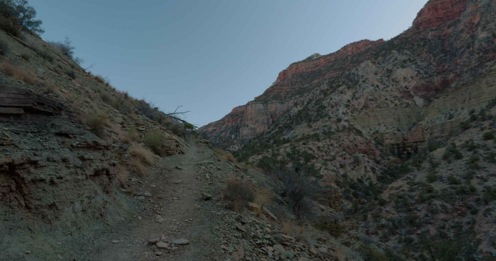
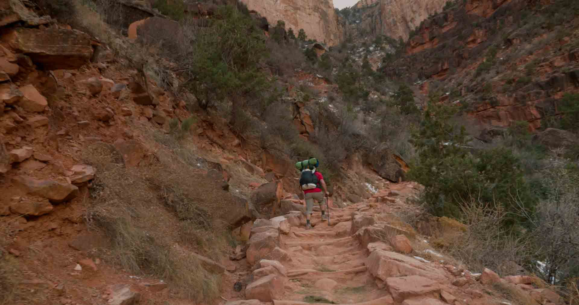
DAY ONE
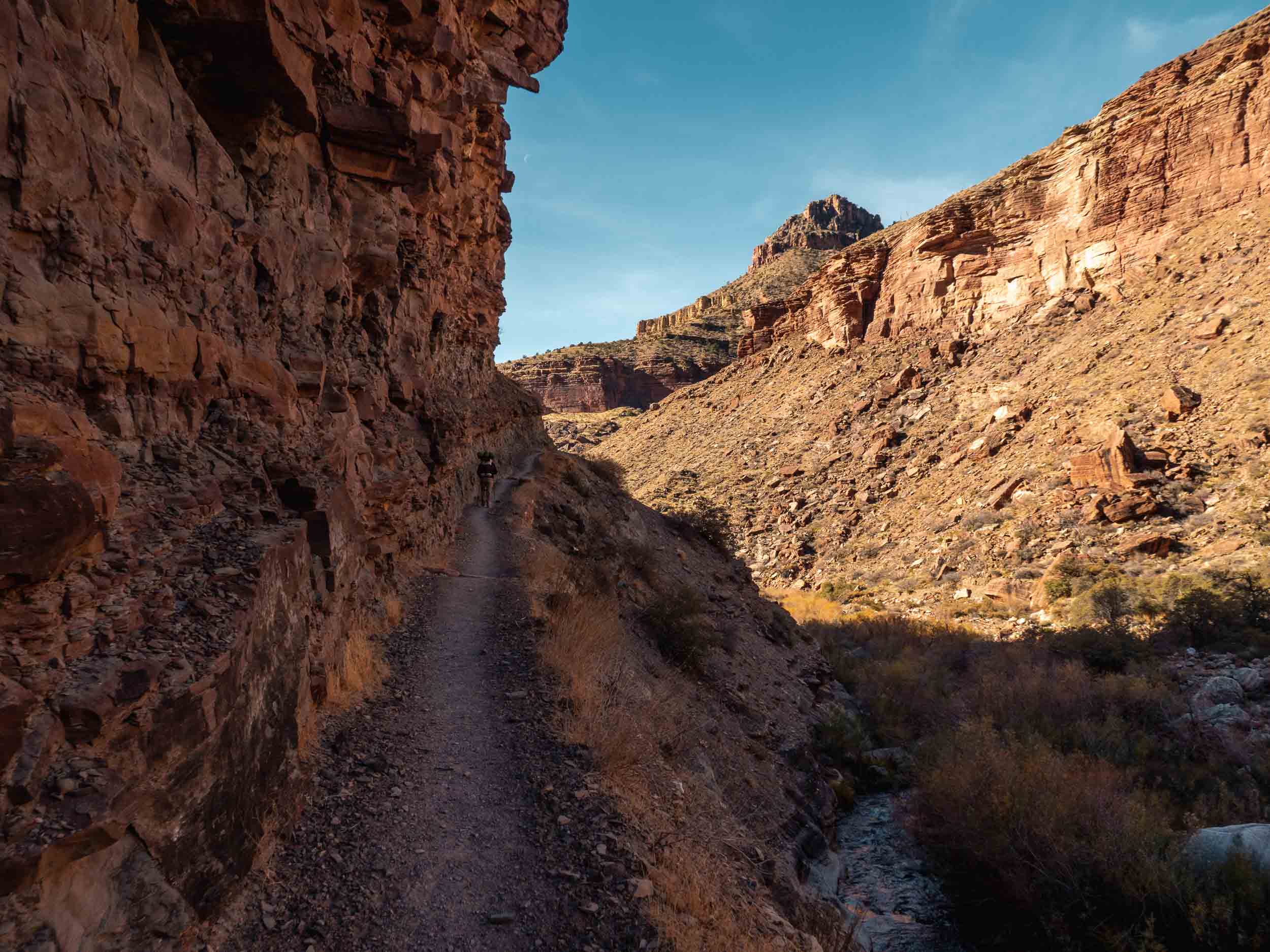
I had hiked the South Kaibab Trail from rim to river and back a few months prior, and as such was relatively familiar with what to expect this first day. Even so, the first few hundred yards of our hike along the switchbacks at the beginning of the trail were surreal. As you’re lowered below the canyon’s walls, they seem to separate you from the outside world and isolate you within the world of the canyon.
This calms the mind and gives a feeling of immediate mental presence I haven’t experienced elsewhere in nature. And layered on top of this feeling was the excitement that we’d be immersed in this environment for the next five days; we had plenty of time to savor this experience.
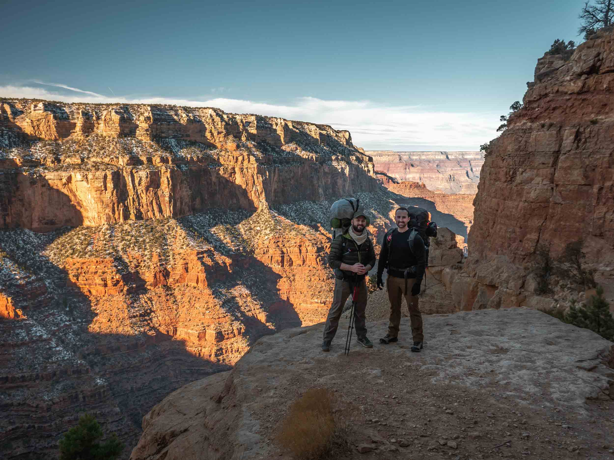
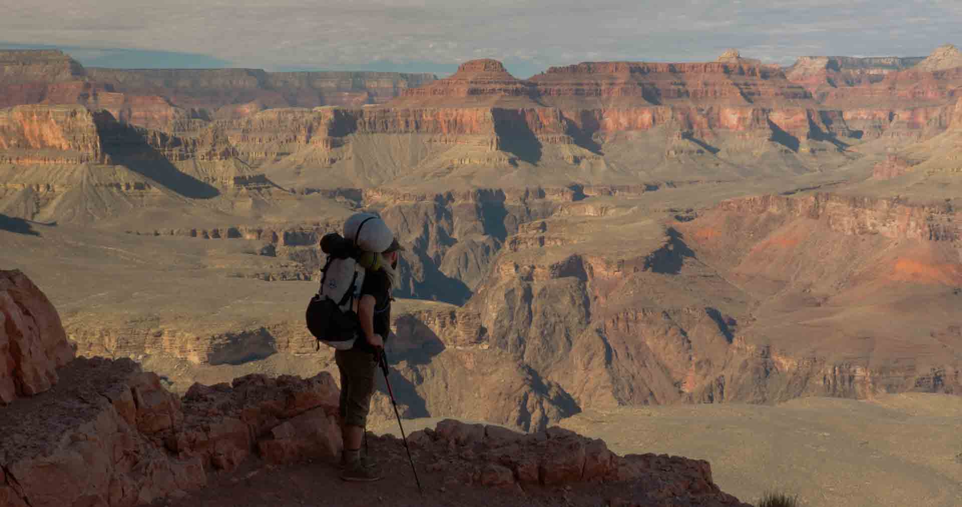
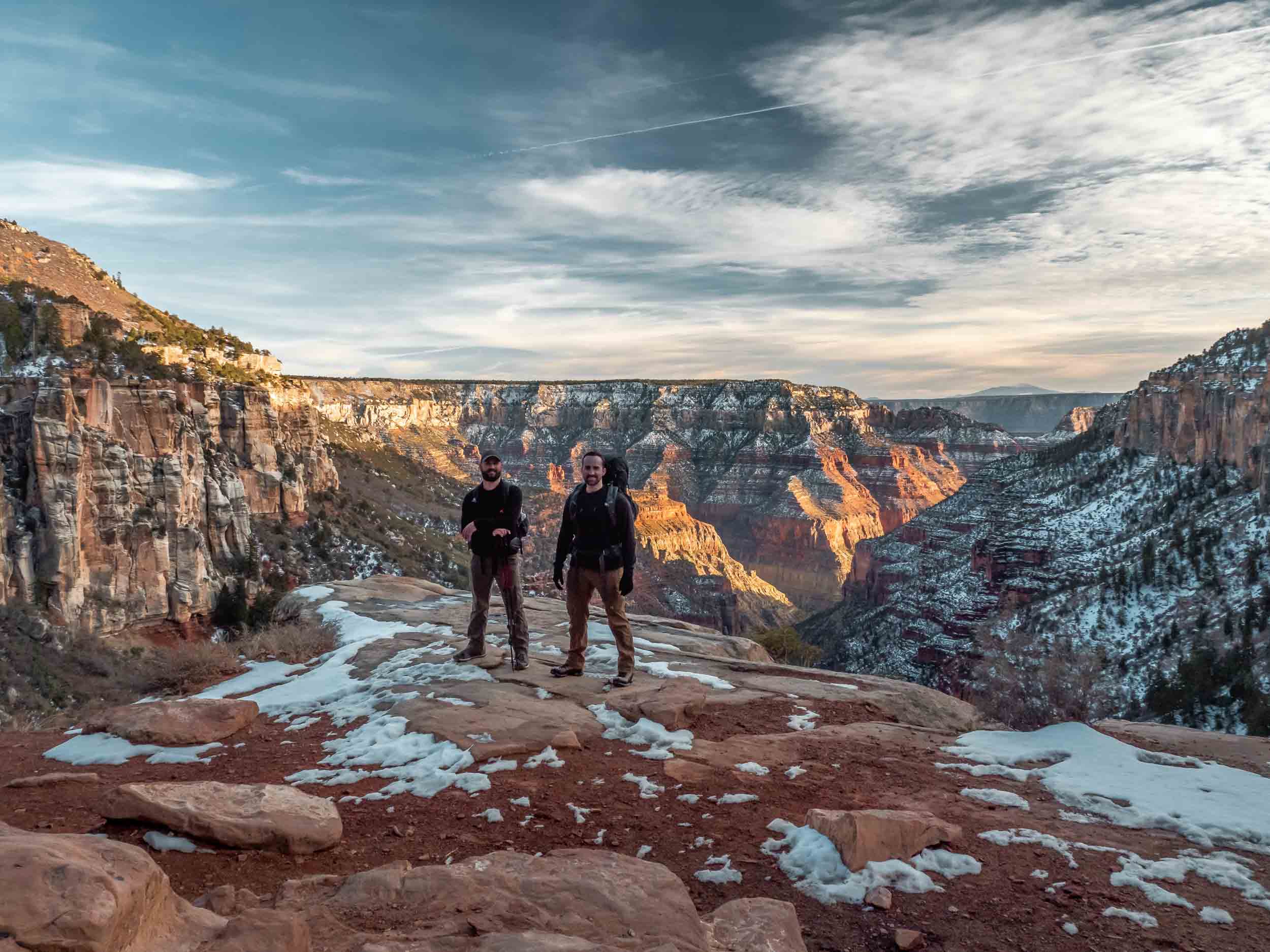
Tyrel and I excited to begin our adventure just a few hundred yards below the rim. And the beautiful vista off to our left as we made it past the first set of switchbacks (still frame from the accompanying film).
We took our time easing down the trail, taking frequent stops to stare out at the scenery around us. Every bend seemed to reveal a new expansive vista. This stop-and-go style of hiking is why we’d decided to spend five days here, while the journey could feasibly be completed in four, or even three.
Along South Kaibab Trail are several notable stopping points that divide the trail into segments. We’d passed the first notable stop at Ooh Aah Point (so named for the staggering character of the view) and had made our way to Cedar Ridge. This is really the first large flat area suitable for a prolonged break on your way down to the River. It serves as a sort of viewing platform on which to walk around and take in the canyon’s views away from the busy South Rim. And that’s exactly what we did.

The view as we passed Ooh Aah Point, and Tyrel and I stopping to admire the views at Cedar Ridge (still frames from the film).
After a short respite, we were back on the trail, passing O’Neill Butte (a landmark that lets you know you’re a quarter of the way to the river). And a bit later, we had made it to the next notable stopping point: Skeleton point.
Like Cedar ridge, it’s a great area to take in the views around you, which continually change as you descend into deeper and older layers of rock.
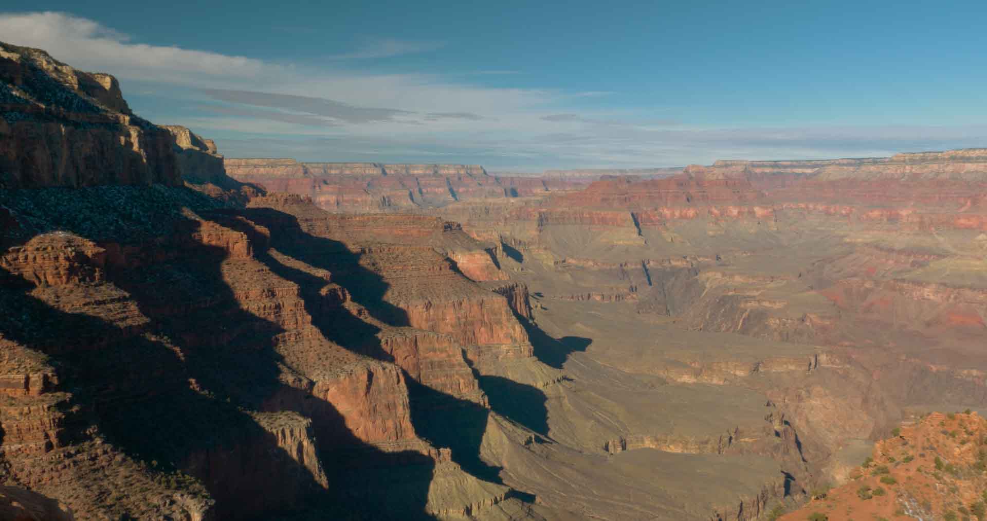
A panoramic photo of the view to the East just before we passed O’Neill Butte.
Just past skeleton point, we came upon the switchbacks, colloquially known as the Reds and Whites, due to their color. As you descend this series of switchbacks, you traverse a distinct division in two layers of rock.
The upper section is mildly red in color, while the lower is a desaturated tan. As we peered down over the switchbacks, we saw the famous grand canyon mules ascending from below, so we stopped to let them pass before continuing on.
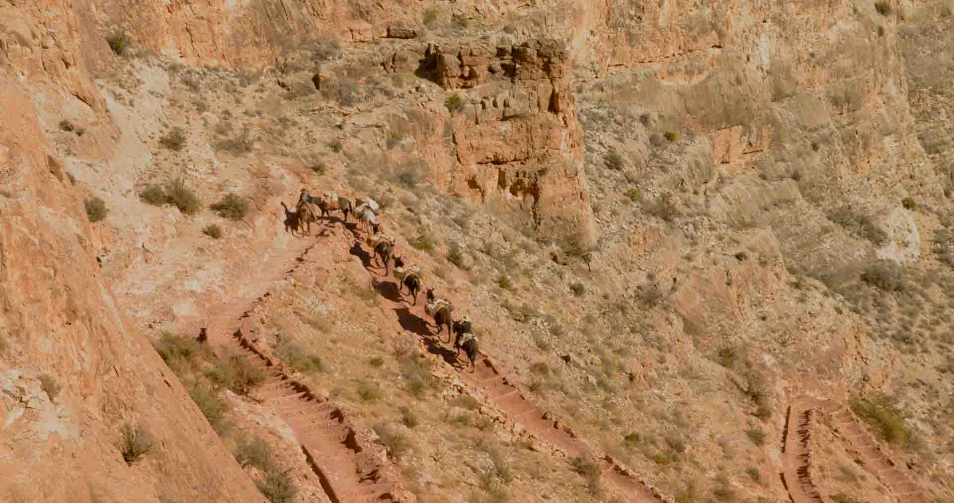
Tyrel stopping to stare just after we passed Skeleton Point. And just a bit further we peered down on the famous Grand Canyon Mules as they climbed the Reds and Whites. (still frames from the film)
Watching the mules walk along the trail is certainly a privilege – a sort of glimpse into the past. Of course, they persist to this day as the most efficient means of transporting gear and provisions to phantom ranch. And as they completed their trip on the switchbacks and turned around a distant corner out of sight, it was our turn on the switchbacks. It was at this point that I remember the anterior part of my knees beginning to hurt; my patellofemoral joint compartment wasn’t used to the constant pressure and friction the hike down created. Ibuprofen would be my friend over the next several days.
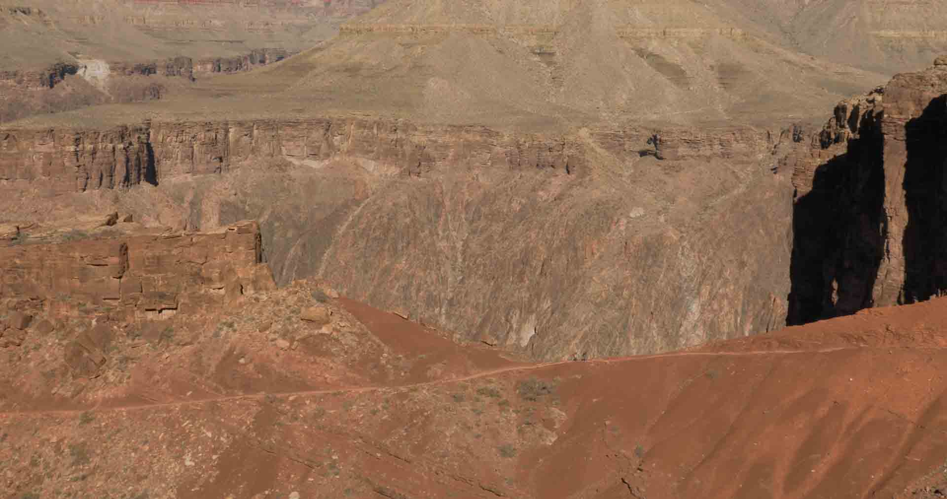
After making it down the switchbacks and the gentle curving decline just after them, we found ourselves at the Tipoff, our next stopping point. This area sits on an expansive shelf of the canyon just before the final steep, switchback ridden descent to the river. In 2019, they installed a small shelter here to give hikers a respite from the intense sun. We sat in this little shelter for a good thirty minutes resting our legs and rehydrating. And then, it was time for the final descent to the river.


Starting down the switchbacks (Reds and Whites) after letting the mules pass, our first glimpse of the two buildings at The Tipoff in the distance, stopping to rest in the shelter at The Tipoff, and the view to the West from the Shelter. (still frames from the film)
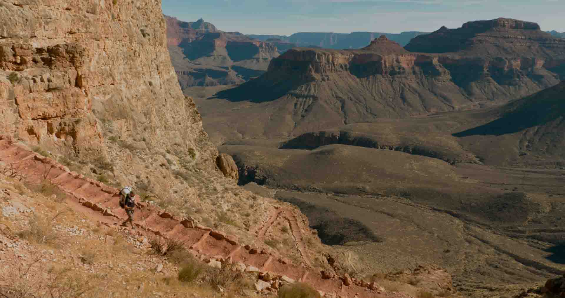
Along this final part of the trip down to the river, you traverse the deepest and oldest rock layers. Whereas the dominant colors of the upper layers are light orange and tan, this section of the canyon introduces deeper reds, maroons, and even blacks.
The walls appear more jagged and haphazardly placed. And with the river now closer and larger in your view, the overall scene is more dramatic.


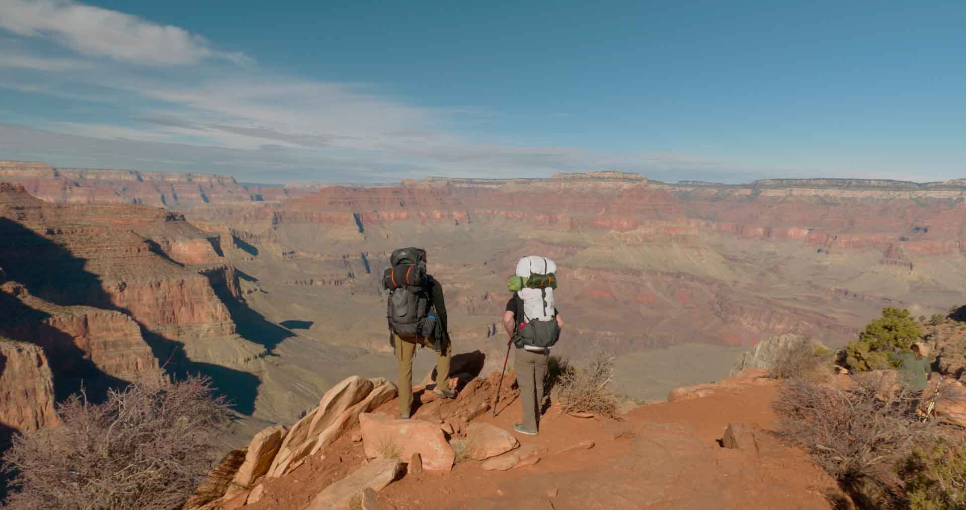
Descending further just after The Tipoff, two hikers ascend a long straight portion of the trail down below, Tyrel stopping to look down at the river, and the view down at the river and buildings just outside of Phantom Ranch. (still frames from the film)
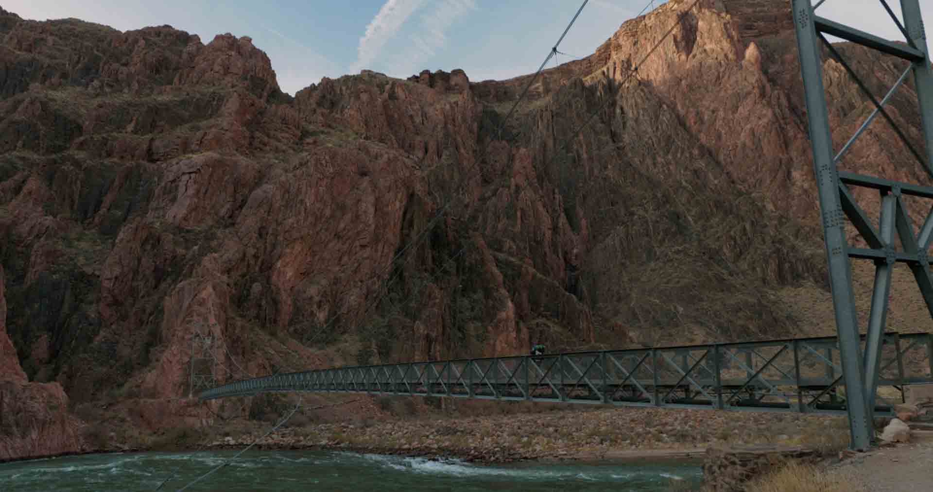
The river below was a striking greenish-blue, with packrafters lackadaisically floating on its surface. We continued deeper and deeper, and finally the Black Bridge that would carry us across the river came into view below. And a few switchbacks later, we were standing in front of the small tunnel leading to the bridge.
We paused for just a moment, contemplating where we’d started this morning, and the fact that we had made it to this final landmark before reaching the river. And then, we started through the tunnel.
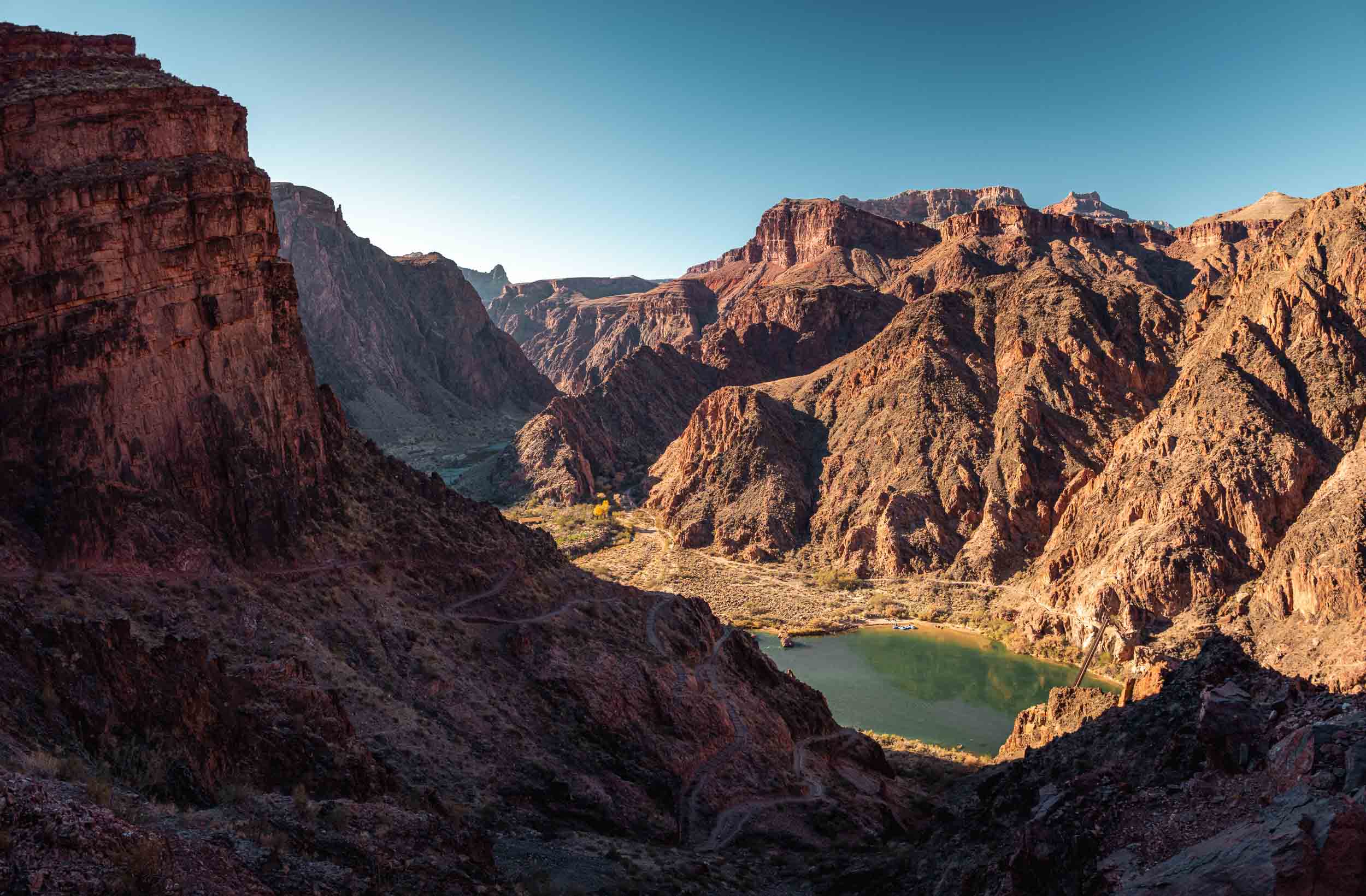


The view of the striking blue-green waters below with pack rafters tied up at the shore and dozens of switchbacks in the shade of the canyon’s walls, the view after turning a corner with the walls out of the way, Black Bridge coming into view below, and the view just before we entered the tunnel before Black Bridge. (one photo and three still frames from the film)
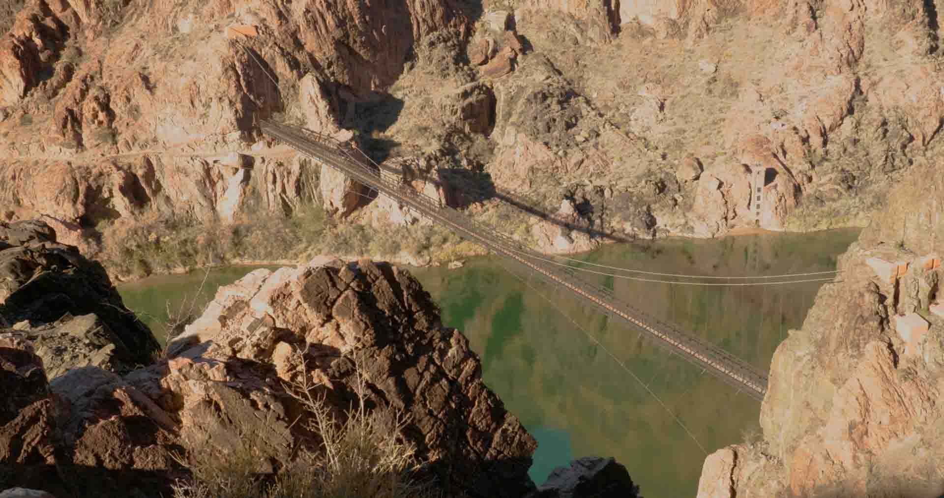
Walking through this tunnel heightened the drama of having nearly reached our destination. Once inside and around a small bend along its course, the only thing you see is the small opening ahead and the bridge cables and canyon walls on the other side of the river glowing in the sun. The sounds of the wind blowing over rocky outcroppings and subtle rush of the river that we’d become accustomed to over the past couple of miles were gone, traded for reverberations of our own footsteps off the tunnel’s walls and ceiling.
Our eyes became accustomed to the dark, such that as we reached the distant end of the tunnel, we found ourselves temporarily blinded by the sun as we took our first steps onto the wooden planks of the bridge. The sounds of the river 50 feet or so below our feet again cascaded into our ears and the vivid greenery on the river’s shores came into view. A truly rewarding sensory experience to celebrate having essentially reached our destination.

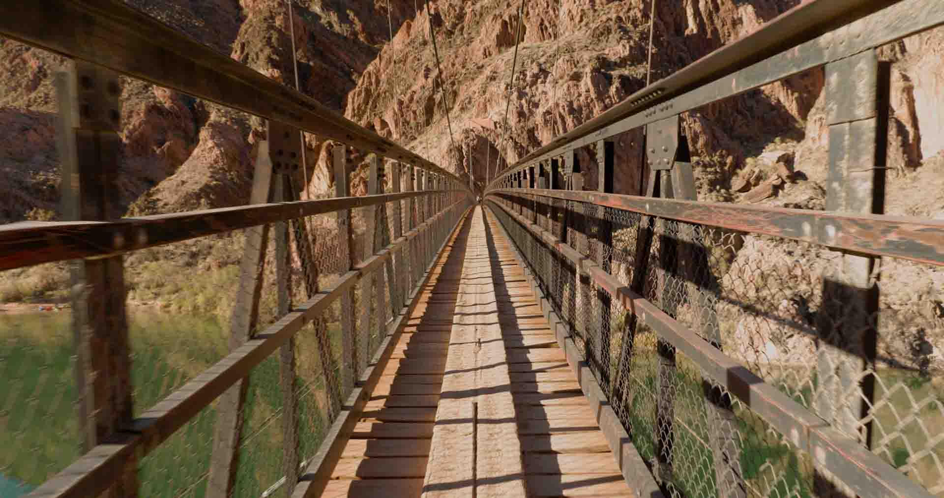
The tunnel’s pitch black walls and Black Bridge glowing in the Sun at it’s end, and beginning the walk across Black Bridge over the river. (still frames from the film)
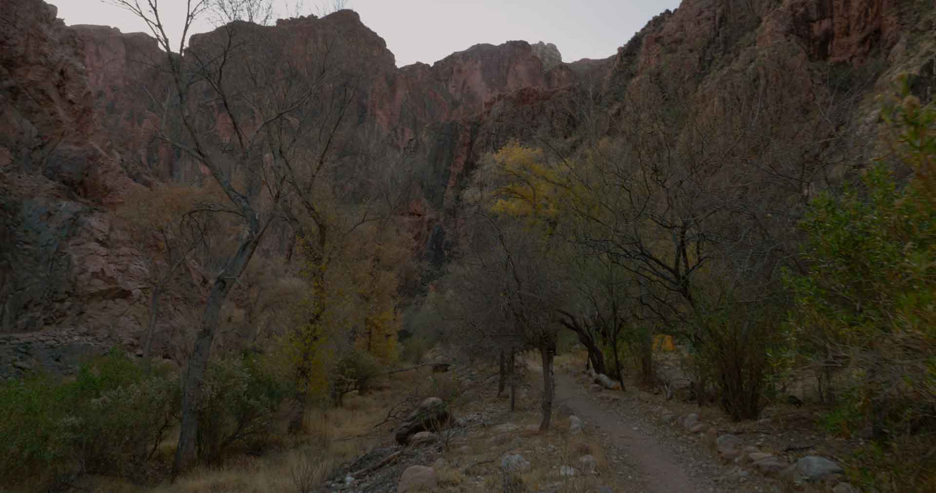
The only thing left to do was hike about a quarter mile along the flat canyon floor to reach Phantom Ranch, which in itself, is another rewarding sensory experience. Beautiful cottonwood trees stood on either side of a stream flowing through the phantom ranch area.
Lush greenery like that along the river’s shores was all around, contrasting the dark red-orange walls that closely surrounded the campground. We selected a site just a few feet from the stream, setup camp, and relaxed at the picnic table placed in the campsite.

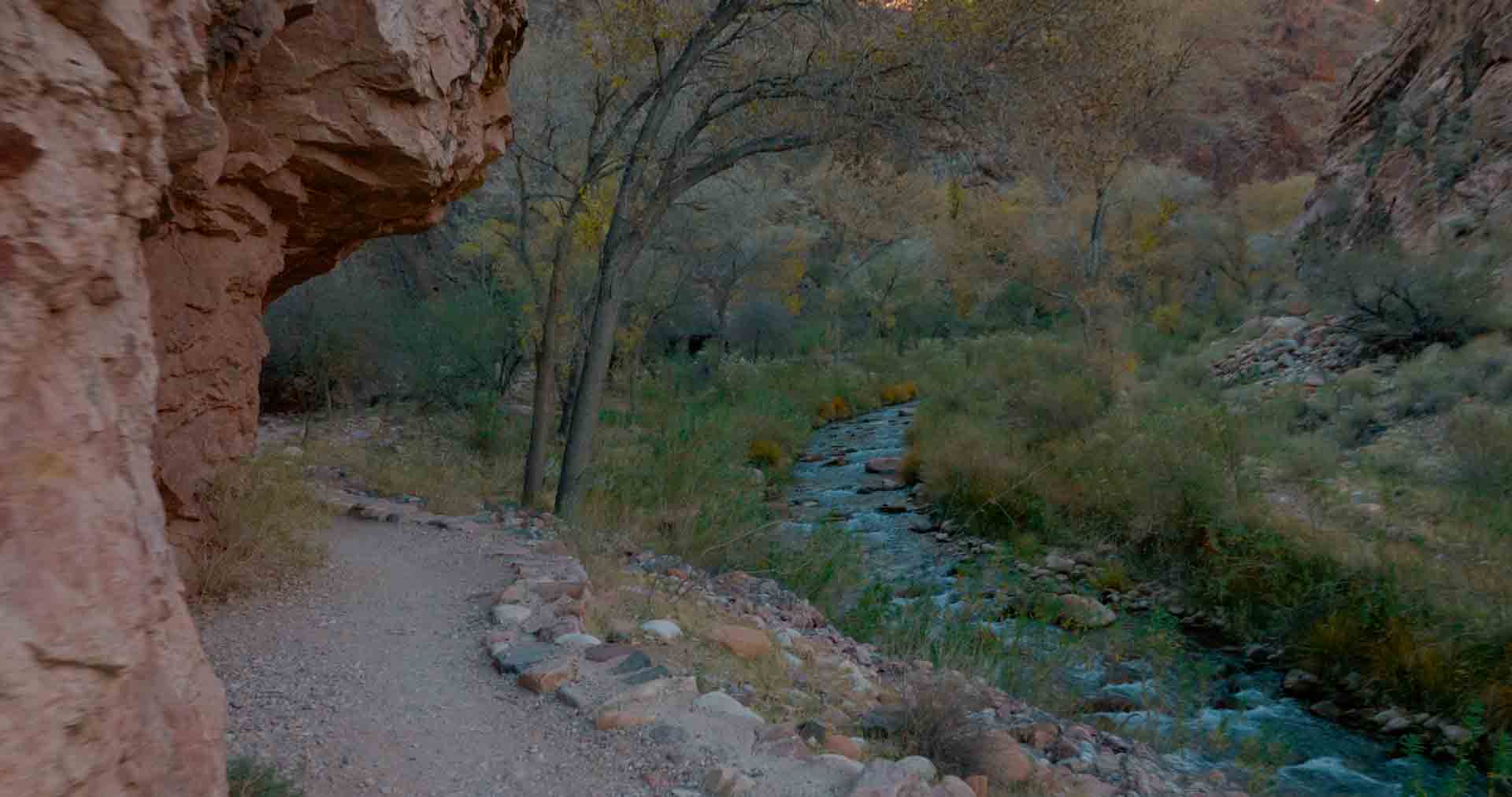


Walking amongst the lush greenery along the bottom of the canyon before reaching Phantom Ranch, turning North to walk along Bright Angel Creek into Phantom Ranch, a view of the campsites along Bright Angel Creek, and Tyrel and I sitting at a picnic table staring up at the South Rim where we started earlier that morning. (still frames from the film)
We’d ordered a hot meal prepared at the Phantom Ranch Canteen consisting of a salad, stew, and desert, which would be ready at 5:30. Eventually, dinnertime came, and we ate our stew as the sun dropped below the canyon walls projecting high in the sky. I remember thinking about the relative luxury of camping in such a developed area while backpacking.
Never before had I had the option of a prepared meal in the” backcountry”. There were even bathrooms with running water (but alas, no showers). After dinner, we turned in not much later than 8pm, and were lulled asleep by sounds of the stream at the edge of our camp.


The dimly lit windows of Phantom Ranch Canteen just before we picked up our pre-ordered hot meal, and us enjoying this hot meal before bed on night one. (still frames from the film)
DAY TWO
We woke up with the sun, having had a fairly restful night of sleep. Some coffee and Mountain House freeze-dried breakfast meals down the hatch, we packed up and camp hit the trail.
Soon, we were at the northern border of phantom ranch, and continued forward to begin hiking the North Kaibab Trail. The destination for the day was Cottonwood Campground.


Eating a quick breakfast in camp before getting on the trail, and the view back toward the campground as we crossed a bridge across Bright Angel Creek. (still frames from the film)
The first section of the hike was a relatively flat section of trail winding back and forth next to a stream (the same one flowing through Phantom Ranch) with tight canyon walls on either side of us.
Scattered throughout the path forward were some small bridges to cross from one side of the stream to the other. The walls blocked the sun, allowing us to hike quickly in the cool temperatures.

Beginning the first part of the trail through progressively tighter canyon walls, and crossing another bridge across Bright Angel Creek. (photo and still frame from the film)
The canyon walls began to distance themselves from the trail and we were eventually hiking up the middle of the wide open canyon floor. The relatively flat terrain gradually increased it’s slope into a steady incline. Desert vegetation decorated the ground all around us. We hiked this way for a few miles before we came upon a steep hill.
After the hike down from the rim the day prior, our energy stores hadn’t completely recovered, and our legs were fairly tired. As such, this steep hill was somewhat unwelcome. We trudged slowly up and over it, and descended the steep slope on the other side, ending up at the same elevation we were before the hill. In short, our work over the hill resulted in no net elevation gain. Colloquially, this hill is called “asinine hill”, a fitting name.


Hiking along the canyon floor after emerging from the tight canyon walls, looking back to the South from where we’d come, Tyrel feeling exhausted as we climbed over “asinine hill” (I was too, out of frame), and descending from the peak of “asinine hill”. (still frames from the film)
Continuing along the trail, we eventually came to a segment traversing some leafy trees, our first opportunity for shade in several miles. We took advantage of this opportunity, and I sat on a rock drinking water, looking up at the canyon walls on either side of me.
And before too long, we got back on the trail moving forward up the gradual slope.


Crossing a small creek along our route, and I sit in the shade to rest about halfway to Cottonwood Campground. (still frames from the film)
The slope again steepened, not quite to the same degree as asinine hill, but for a much longer distance. For what we thought would be a relatively easy hike setting out that morning, we were pushing our legs much harder than expected.
Thankfully, we soon reached the crest of this long sleeping segment, and at the end of a long decline were groupings of cottonwood tree in the distance: Cottonwood Campground.


Tyrel walking in the shade along the final descent to Cottonwood Campground, and our tents setup in the Northernmost site in the campground beneath the glowing canyon walls at golden hour. (still frame from the film, and photo)
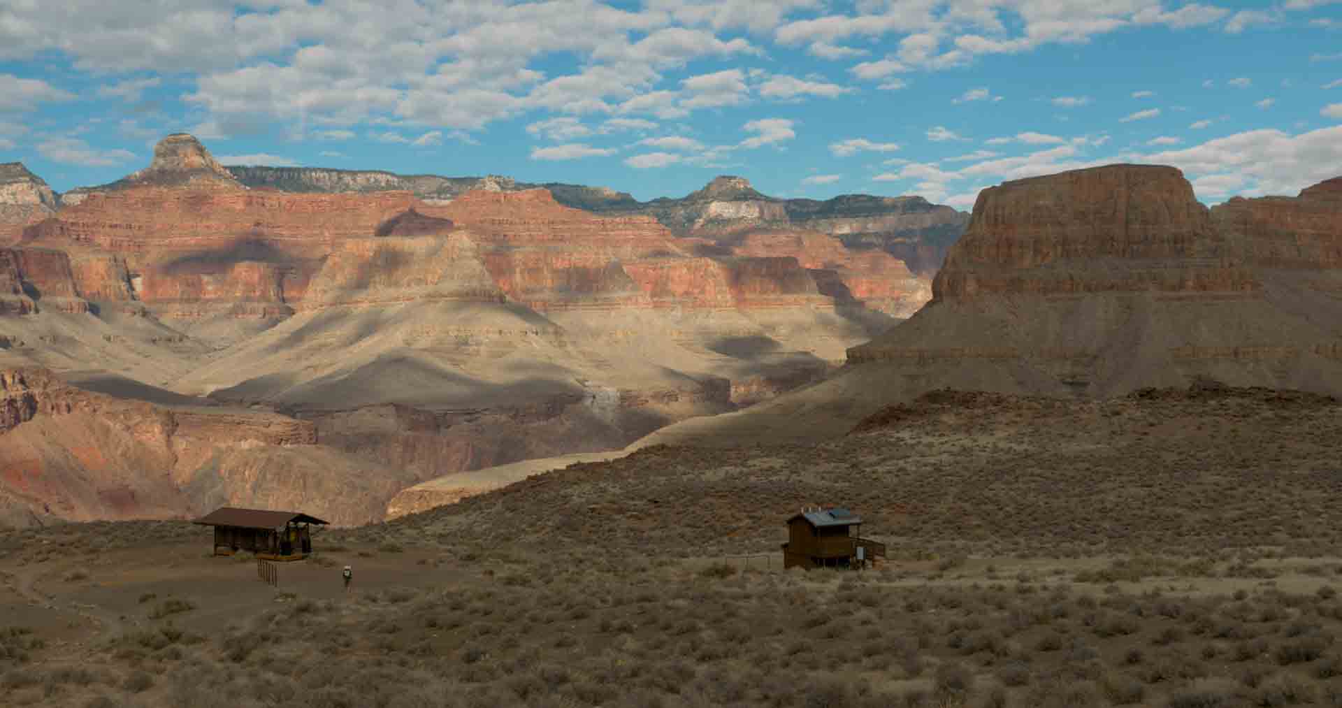
Walking into Cottonwood Campground, it seemed to be a miniature – and more remote – Phantom Ranch. There were small buildings with pit latrines and a Ranger outpost, with campground scattered about the canyon floor. With plans to head North tomorrow, we picked the Northernmost campsite, setup camp, and rested our legs.
But before we let the Sun set, we hiked to a nearby creek to refill on water. Then, stocked up for tomorrow’s aggressive trek up and down the North Rim, we tucked in for a good night’s sleep.

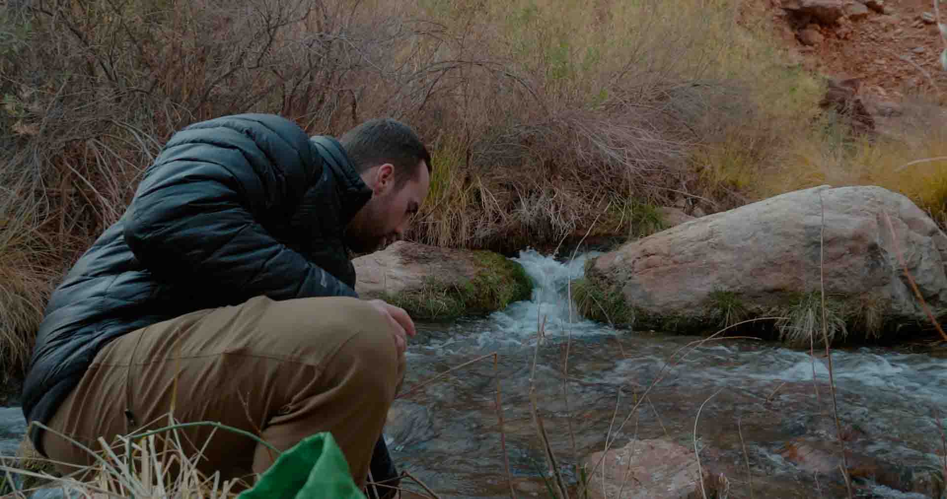

Tyrel and I fill our water stores from Bright Angel Creek next to Cottonwood Campground, and the view of the stars to the North from our campsite. (still frames from the film, and photo)
DAY THREE
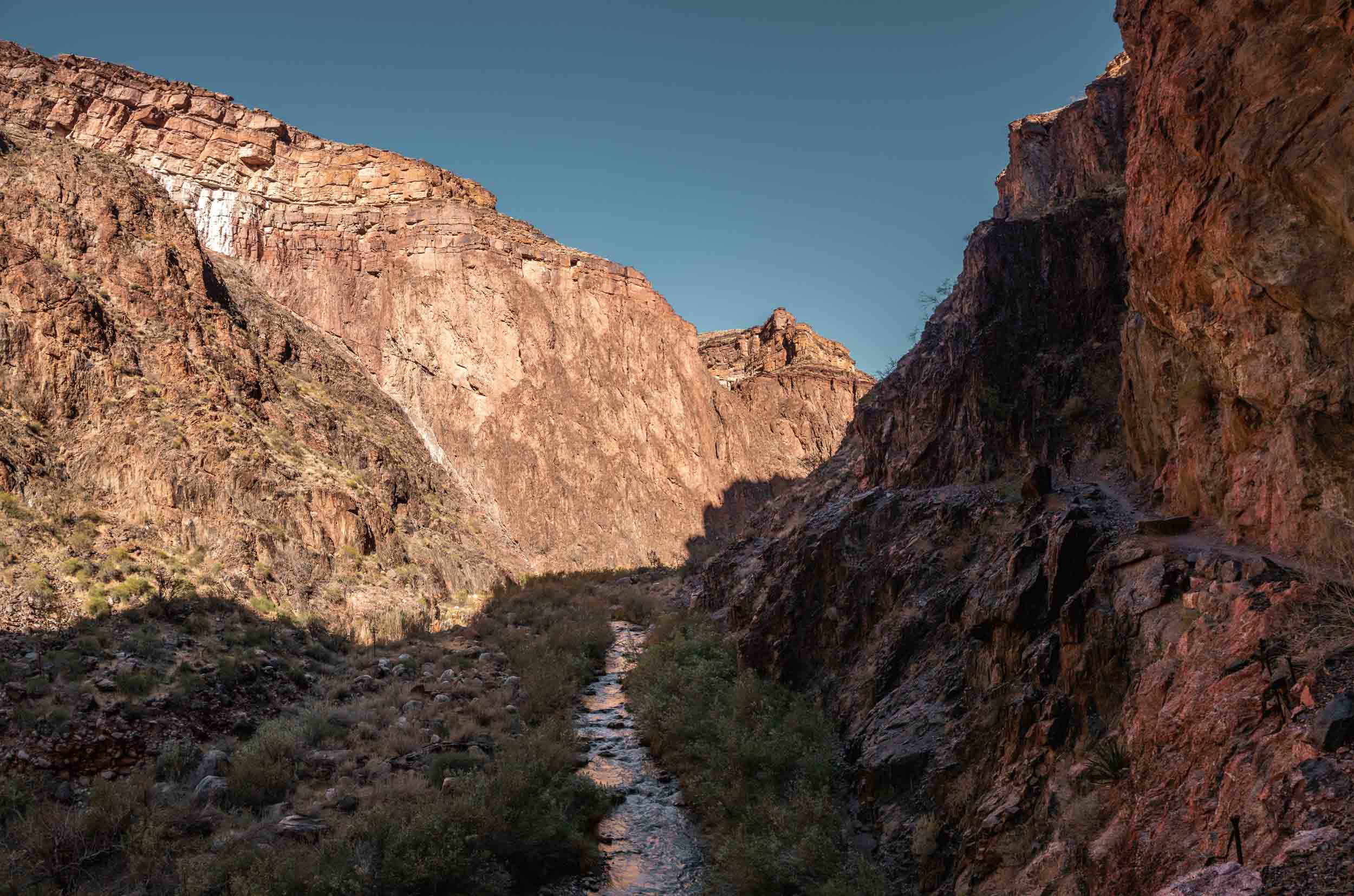
It was still dark, but my watch told me it was time to get up and get going. We’d be covering a little over seventeen miles today, and we didn’t want to be hiking the steep walls and cliffs on the path back from the North Rim in the dark. The previous morning we’d sat at camp eating a warm breakfast before starting on the trail. This morning, however, we skipped breakfast, planning to eat some carb-filled snacks as we trekked to the North Rim.
The first mile or so of our hike was probably the most peaceful I’d ever encountered. We hiked the relatively flat first portion of the trail in silence. The only sounds were those of our own feet on the rock and dirt trail beneath our feet, a small stream off to our left, and light gusts of wind over some rocky protrusions along the walls high above our heads. The sun was still below the horizon, but its light began to dimly fill the sky above, casting everything in a diffuse magenta hue.


The early morning hues and canyon views as the Sun came up along the start of our hike to the North Rim. (still frames from the film)
As more and more light filled the sky, we traversed a small metal truss bridge across Bright Angel creek, formed by Roaring Springs somewhere further up the trail. And almost immediately after the bridge, we walked into the Manzanita rest area. In this flat little area on the shore of the creek, with scattered small wooden buildings and benches, stood a map of the trail with a “You are here” marker. We’d covered about 1.5 miles, with another 5.1 to go. At least, that was the plan for now. And doing some extrapolation of our pace so far this morning, the distance left to the rim didn’t’ sound like much; the sun still wasn’t up and we’d already covered about 23% of the distance to the rim. My confidence grew.
As we got back on the trail from Manzanita, my confidence was immediately destroyed. Whereas the first part of our hike had been over flat terrain, we now started our relentless ascent to the North Rim. After less than 100 yards, my heart was pounding and legs were exhausted. Today would be a bit of a struggle. However, as with any struggle in the outdoors, the surrounding beauty provided a sort of moment-to-moment reward for pushing further, keeping the experience enjoyable.


Another truss bridge across Bright Angel Creek, coming into the Manzanita rest area just on the other side of the bridge, starting the steeper climb to the North Rim just after Manzanita, and some of the constant amazing views along our climb. (still frames from the film)
We continued our ascent, the views becoming increasingly more beautiful with every short step. The hike down the South Kaibab Trail on day one delivered views over vast vistas filled with undulating layers of orange rock as far as the eye can see. The effect is overwhelming. But what we saw now as we hiked up the North Kaibab Trail was somehow even more so.
We found ourselves surrounded on either side by vertical walls stretching up to the sky, with protrusions along their faces forming bright red-orange columns, glowing in the Sun that had just risen above the horizon. The path forward was along a cliff, no more than five feet wide in some places, winding along the leftmost rock face. And this close proximity to these otherworldly rocky formations creates a feeling of personal insignificance that I think is the root of enjoyment in beholding natural spectacles.


Some of the otherworldly views along our cliffside trek to the North Rim.
Eventually our path brought us to Red Wall Bridge, the longest canyon bridge we’d encountered thus far, traversing a large ravine. We stopped for a bit to rehydrate, standing in the middle of the bridge looking down at the valley below. Each break we took was longer than the last. Finally, after what was probably about twenty minutes, we pressed onward.
A few switchbacks later we were at Tsupai Tunnel. And just on the other side was another little flat bit of land meant as a rest stop. We didn’t rest, however, and instead continued trudging up the trail.
It was just past this little rest area that we encountered the first snow of the day. The North Rim stands about a thousand feet higher than the South Rim, meaning that a larger proportion of the North Kaibab Trail is affected by snow when compared to the South Kaibab Trail. And with the decrease in temperatures comes a change in plant life. As we continued forward we left the sparse bushes of the desert behind and encountered more and more coniferous evergreens. Under their cover, we dawned more layers against the cold of the shade.


Tyrel and I rest at Red Wall Bridge, Tyrel as we continue our steep climb just past Red Wall Bridge, and the view as I walk through Tsupai Tunnel. (still frames from the film and a photo)
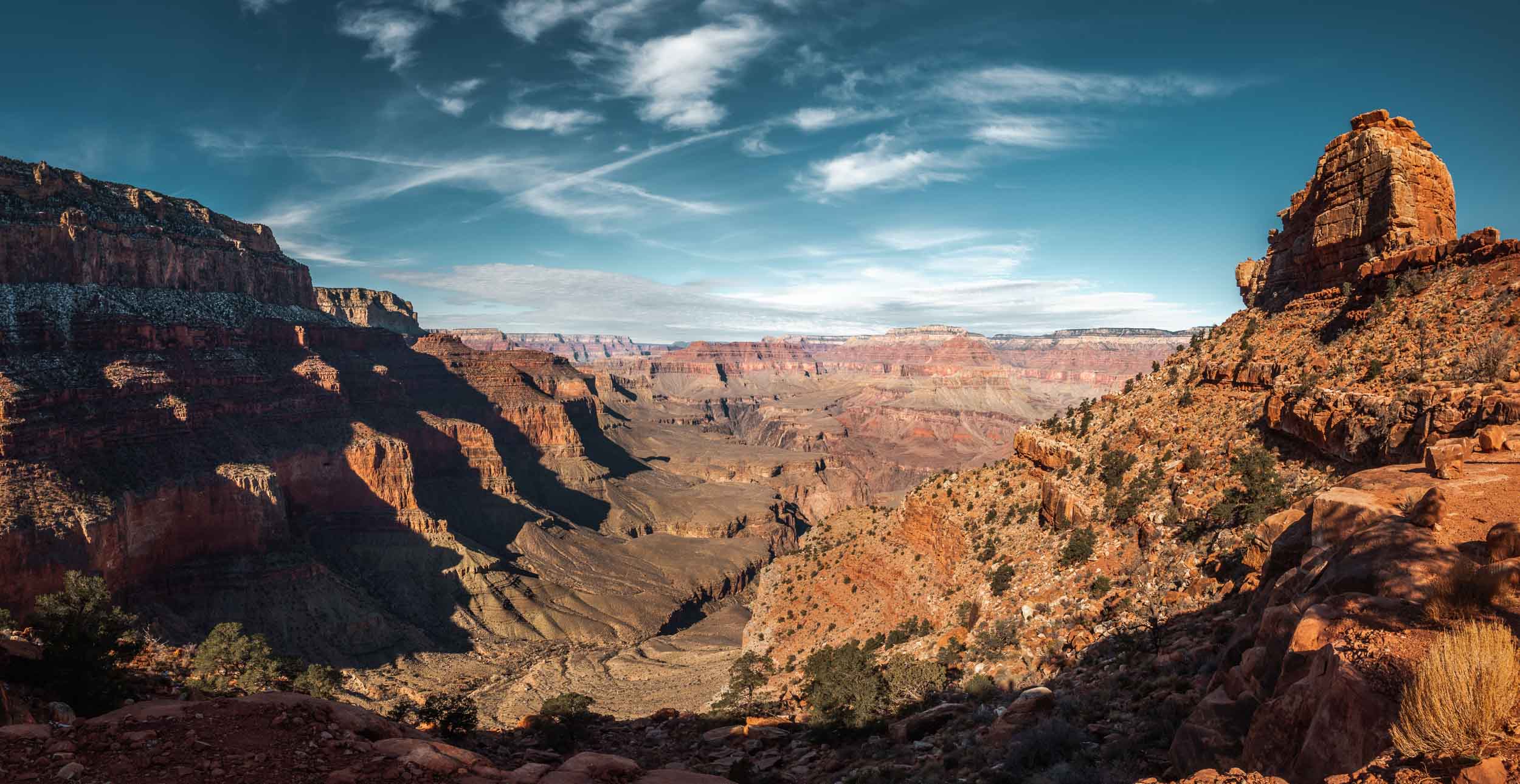
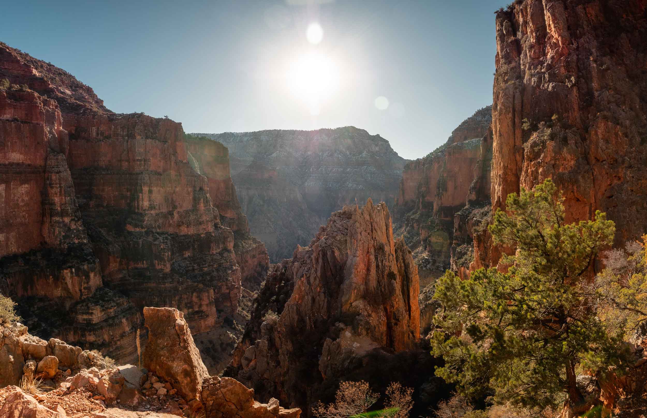
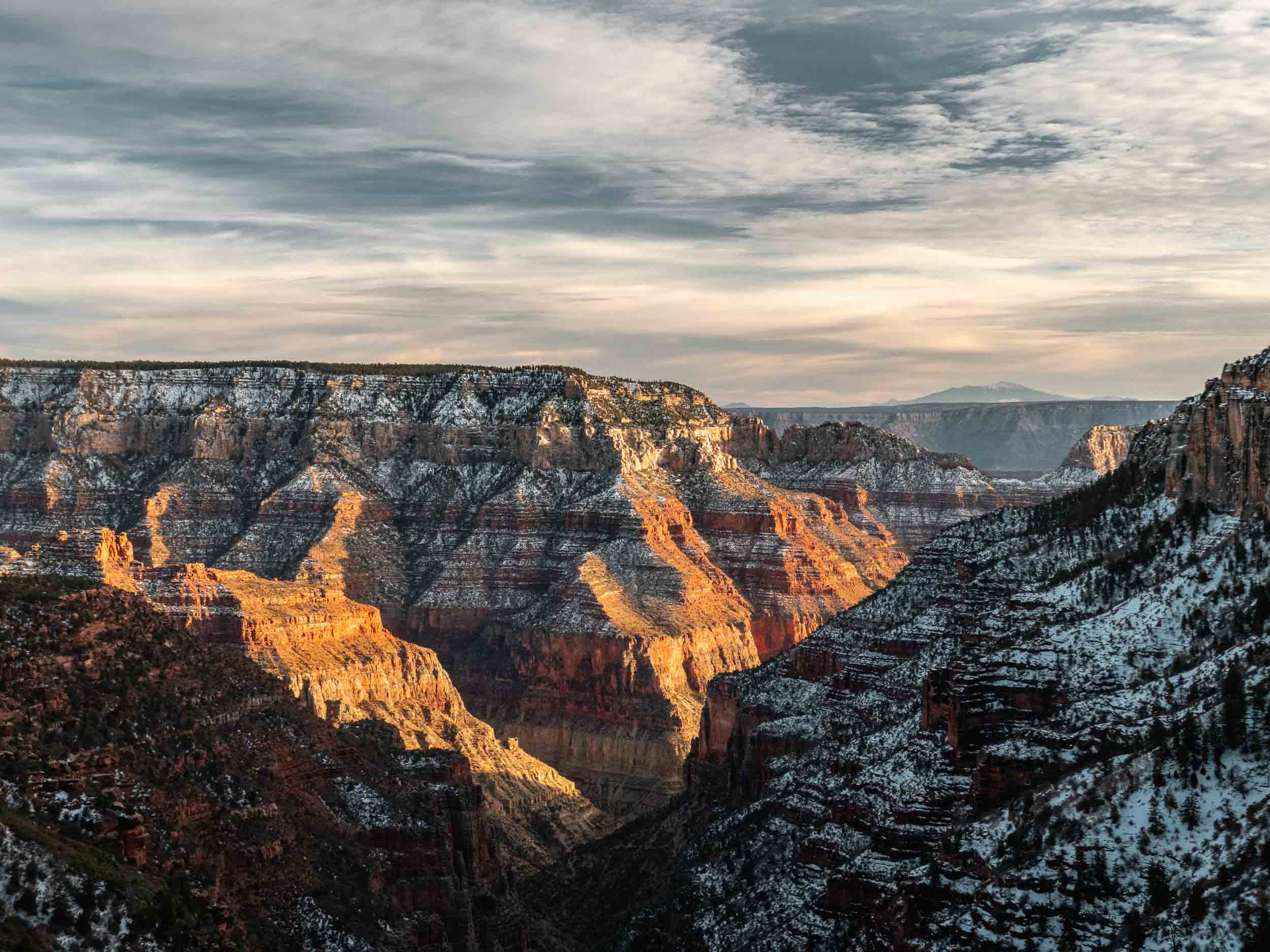
Some double-digit number of switchbacks passed, each step a small mental battle against our desire to stop for rest, and we finally came upon Coconino Overlook. This little viewpoint lets hikers stand out on a shelf of rock, probably about 50 x 30 ft in dimension. From the edge of this shelf, you can see nearly the entirety of the winding path up the canyon from Red Wall bridge below. Out in the distance, you see the gradually eroded rock faces characteristic of the Grand Canyon. And out further still, you see distant mountains on the horizon, like the snow capped tallest point in Arizona: Humphrey’s Peak.
Our rest here was even longer than previous ones, with Tyrel heating water on his stove for a hot (freeze-dried) meal. We’d been hiking essentially all day on nothing more than nuts and cliff bars, so taking the opportunity to get something more substantial in the stomach made sense. After all, we hadn’t yet reached the top, and even after we did, we’d have to hike all the way back down.


Struggling up the endless switchbacks along our route, Tyrel catching his breath, entering the part of the trail covered with snow, and nearing Coconino Overlook where we stopped for a good while to rest. (still frames from the film)
With our bodies and lungs slightly recharged, we continued up the trail. According to my earlier counts of the number of switchbacks to the top, we had two left. However, one switchback passed, and then two, still with several left before the end of the trail. Obviously, I’d miscounted. Of course, it didn’t really matter. The only thing for us to do was keep walking until we reached the trailhead. So we continued onward and upward, trudging over the snow-covered trail lined on both sides with coniferous trees. And just a few minutes later, we had the ending in sight. At the end of a straight piece of trail in front of us were three little stairsteps created by large rectangular stones placed on the ground. And at the end of these stairs was a little flat area of snow-covered dirt with a sign in the middle detailing the North Kaibab trail, ornamented with little pictures of the local wildlife and brief informational paragraphs. We had made it to the North Rim.
As we stood at the top of the North Kaibab trail after spending all day hiking to get there, the elation and sense of accomplishment one might expect after such a feat was notably absent. Off to one side of the small flat trailhead area was a green electrical transformer box. Any view of the canyon in the direction from which we had come was blocked by dense pine trees. And opposite the pine trees was a parking lot and pit latrine building, both closed down for the winter. After putting in the effort to get here, we were rewarded with relative mundanity. The most interesting thing around us were a couple of ravens that seemed to be giving us a stern talking to. We hadn’t hiked all the way across the canyon and up the other side to turn back feeling disappointed, so we decided to keep hiking.


Continuing along the snow-covered trail to the North Rim, and the North Kaibab Trailhead area which ended up being underwhelming. (still frames from the film)
After a quick review of the map, we realized that the trailhead area where we were standing stood on the northern side of a large rocky peninsula projecting out into the main corridor of the canyon. This meant that to see the views we were after -views looking back toward the South Rim over the miles of canyon we’d traversed the past few days- we’d need to hike to the peninsula’s southern side. This was another mile and a half a way, creating a three mile round trip. And by the time we finished this round trip and started back down the North Kaibab trail to Cottonwood campground, it would be nearing sunset. Still, the decision to proceed was easy… Again, we hadn’t hiked all the way here to see some crows, trees, and a closed-down parking lot.
We started hiking, continuing to trudge over snow, zig-zagging through trees which towered above us, the sky only visible in segments of blue between breaks in the foliage. The trail wasn’t exactly marked, so we simply walked in a general direction figuring that we’d eventually come to a steep drop where the rocky peninsula’s plateau of land abruptly ended. The scenery was beautiful, of course, but perhaps the most interesting thing about this part of our journey was the total lack of people.
The past few days, we hadn’t seen people, but that had been expected. We’d hiked relatively remote trails only accessible from the South Rim. But now that we were at the North Rim, all around us were cabins, ranger buildings, electrical transformer facilities, campgrounds, bath houses, and fire pits. And there wasn’t a soul near any of them. In the winter the North Rim closes to guests. The road which summertime guests use to drive straight to the North Rim Lodge and surrounding attractions is simply closed. And this meant that we had the entire area to ourselves. I felt a sort of pleasant eeriness wash over me. It was as close to post-apocalyptic exploration as I hope to ever come.
Eventually, the land below our feet came to a sudden end, and we looked across a deep branch of the main canyon at a neighboring peninsula of rock about three hundred yard away. These views were better, but still not what we were after. So, we kept hiking, this time pushing further east toward the North Rim Lodge which stood near the tip of our large rocky plateau. The canyonside trail we followed plunged us back under tree cover, until finally, we emerged and all at once saw the rewarding views we’d come for.


Tyrel as we continued hiking from the North Kaibab Trailhead area in search of better views, walking through denser and taller trees which blocked the Sun, our first glimpse of some better views, and the views becoming progressively more staggering as we continued our hike toward the North Rim Lodge. (still frames from the film)
The North Rim Lodge stood proudly near the edge of the North Rim to our left, and a bit to the right was a small rocky outcropping on which the National Park Service built a small viewing platform with galvanized metal railing. It was the sort of platform that, during the Summer, would be endlessly crowded with people wanting to take the best selfie ever. The view from this platform was hands down the most beautiful I’d ever seen, looking down on the entire length of the Grand Canyon’s corridor stretching out into the distance, ending at the unfathomably huge wall of rock that was the South Rim. Further in the distance were the scattered peaks of Arizona, gradually disappearing as the Earth curved below the horizon in the South. And with the North Rim closed in the winter, there were no teenagers (or adults) taking selfies.
There were no retired accountants striving to look like professional photographers with needlessly large tripods and telephoto lenses. There were no people at all. Miraculously, we had this moment all to ourselves.
We stood on this little viewing platform for probably close to half an hour, just looking. We could see the South Rim where we’d started and the winding path through the bottom of the canyon we’d taken to get here. And this vantage put our efforts and the distance we’d covered into perspective, and rewarded us with a truly unforgettable, immensely rewarding moment. One I’ll never forget.


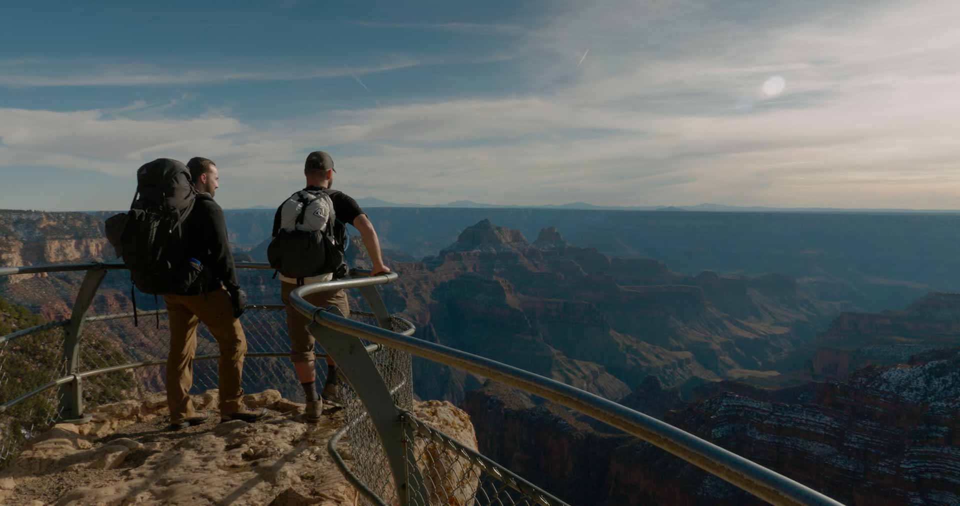


All of the sudden we came upon the incredible views over the Grand Canyon Corridor we’d hoped for, walking out onto the empty viewing platform, the view down at the canyon below, Tyrel and I staring for a long time back toward the South Rim (still frames from the film), and two photos of us and the views.
Unfortunately, we couldn’t stand and stare too long; the Sun was setting rapidly, and we still needed to make it back to the North Kaibab trailhead and then down to Cottonwood Campground. It had taken us about seven hours to get where we stood now, and likely wouldn’t be much faster on the way down. It was now inevitable that a large portion of our remaining hike would be in the dark, so we shifted our goals a bit. We now simply hoped to make it below the level of snow and ice on the trail before nightfall. Slipping and sliding on steep switchbacks with sharp drops a couple feet to our right or left didn’t sound like fun in the dark.
We took advantage of the North Rim closure and, instead of following the winding path through the trees back to the trailhead, we instead walked down the double yellow line of the gently undulating road serving the North Rim Lodge. This helped us cover ground quickly, and before too long, we started our descent from the North Kaibab trailhead.
This first part of our hike could be be described as a race against the setting Sun. We moved as quickly as our tired legs would allow, leaning into unexpected gentle slips on the wet snow and ice below our feet. Even with our rapid pace, as we passed Coconino Overlook, we once again stopped to admire the views. And then, we resumed our mad dash down from the rim.


Hiking along the closed road back to the North Kaibab Trailhead, starting our hike back down, stopping at Coconino Overlook to admire the sunset views. (still frames from the film, and photos)
Thankfully, as we neared Tsupai Tunnel, we left the last of the snow-covered portion of trail behind. There was still a bit of light in the sky as we started down the switchbacks between the tunnel and Red Wall Bridge. But as we continued forward and eventually crossed the bridge, the dim purple-blue skies gave way to blackness. We donned our headlamps and marched onward. The view in front of me was one of a well-lit pale brown rocky trail, so long as I kept the light pointed down towards it, with the light gradually fading to black about 20 feet in front of me.
To my left however, there was no such gradual fade. Rather, the light abruptly cut to black about two feet left of my left foot as the ledge on which I was hiking ended. Not wanting to step in that blackness, I hugged the wall as much as I could. Our pace was certainly slower now that we were being careful not to fall to our deaths.


Most of the light had faded by the time we made it back to Red Wall Bridge, and only our headlamps lit the way along the cliffside trails back to Cottonwood Campground. (still frames from the film)
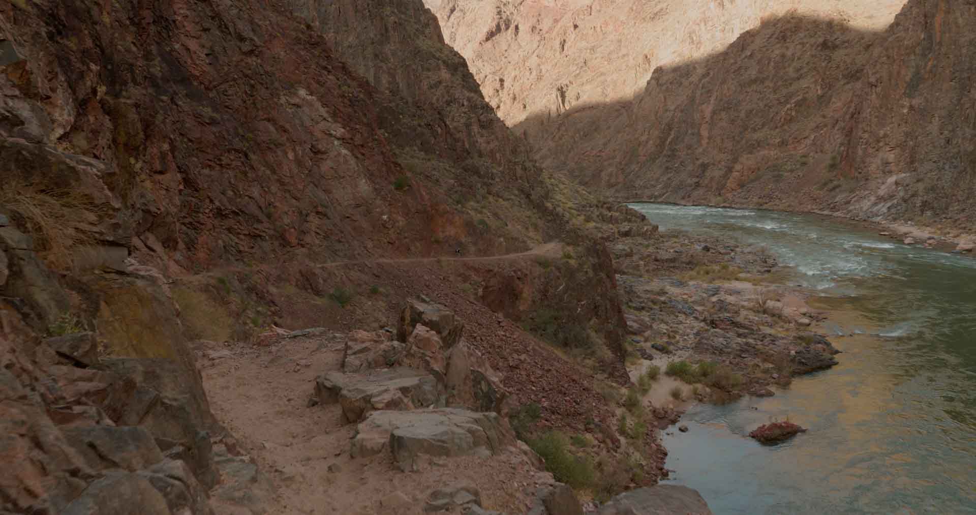
A couple of hours passed like this before the narrow rocky ledges lessened their severity and the steep cliffs to our left were traded for steep downslopes. Now if we stepped off the trail, our descent would at least be an uncontrollable roll instead of a freefall. Eventually, the concerning parts of the trail were entirely behind us, and on our left we saw the warmly lit windows of the pumphouse ranger station. We had made it to the Manzanita Rest area.
With close access to Bright Angel Creek here, we took some time to refill our water stores (which I’m embarrassed to say were completely empty at this point). And then, we hike the remaining miles to the campground. Walking into camp, I was perhaps the most relieved I’d ever been. After setting out about 14 hours earlier, we’d hiked about seventeen miles, all of it either ascending or descending. And thankful to have made it back to camp safely, we went immediately to bed. No dinner, no teeth brushing. My head hit my inflatable camp pillow, and I was out.


The dimly lit windows of the old pumphouse ranger station told us we were nearing the Manzanita rest area, and we stopped to refill our empty water stores from Bright Angel Creek as we walked out of Manzanita. (still frames from the film)
DAY FOUR
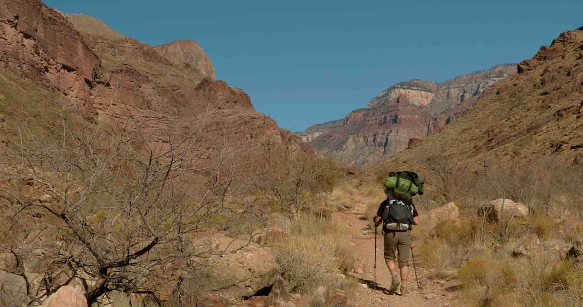
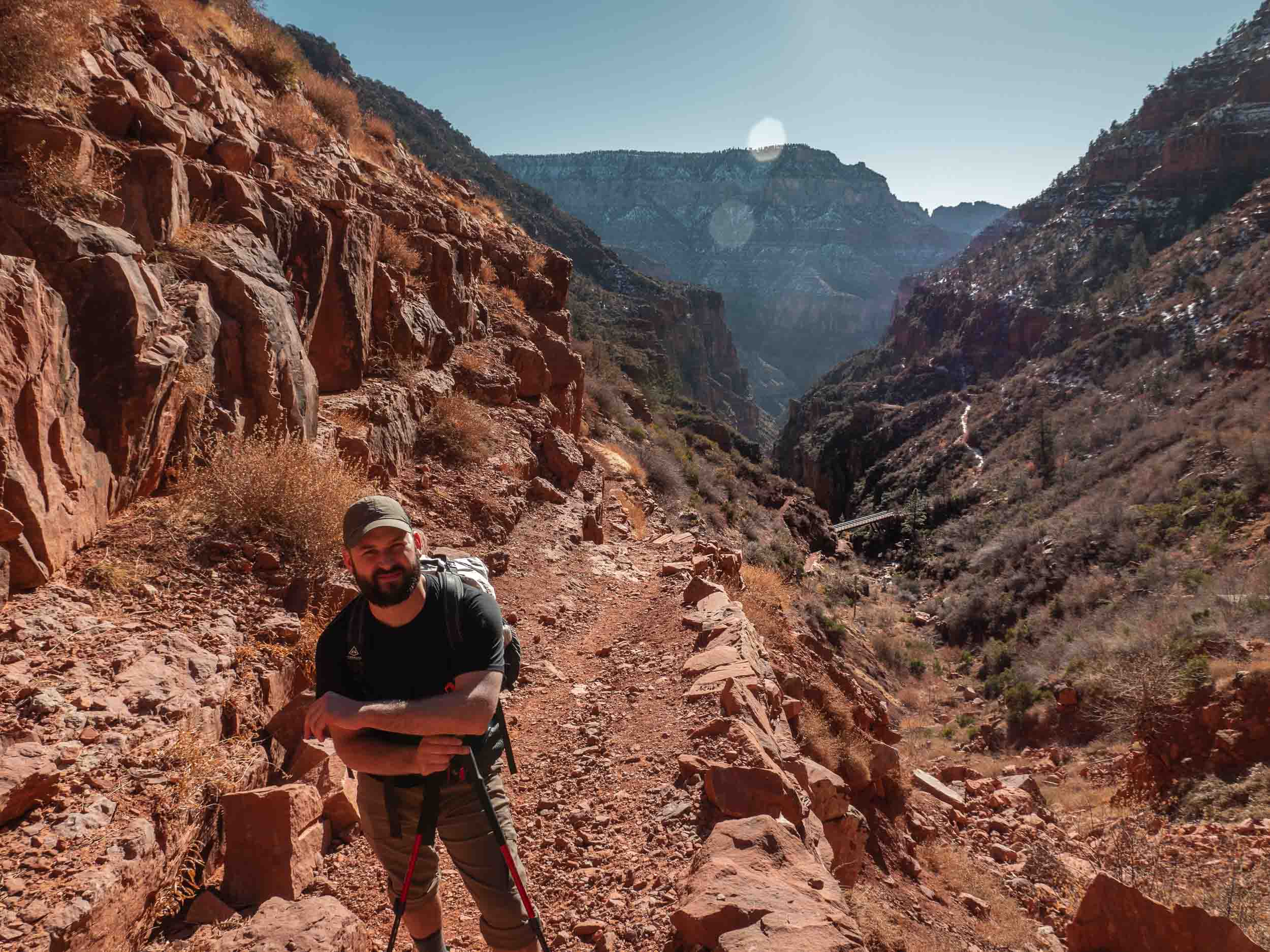
Whereas the day prior had been our most aggressive in terms of difficulty, today would be the opposite. We’d reverse our hike from day two (Phantom Ranch to Cottonwood), this time traveling back toward Phantom Ranch. And hiking in the opposite direction meant that we’d follow a constant and gradual downslope, a welcome break for our legs after yesterday.
We didn’t get started on the trail until after 11am. We’d allowed ourselves the luxury of sleeping in and took time to eat a double breakfast. We hadn’t eaten dinner the night before, after all.
And then, we headed South. We only needed to cover about seven miles over the easy terrain, so there was no need to rush. We settled into a nice relaxed pace and let our minds drift outward to take in the beautiful scenery. On either side of us were the distance walls of the canyon’s main corridor. And after seeing them from above from our vantage point near the North Rim Lodge, these walls took on a new sort of beauty today, with more awareness of their sheer size.

Two photos along our route back South from Cottonwood Campground.
Eventually we came to asinine hill, the same steep up and down hill in the middle of our route, with a net elevation gain/loss of zero. Again, we trudged over its annoying prominence. And on the other side, we knew our path forward would be smooth sailing. As the midday Sun beamed down its intense heat, we began a section of the trail which wound back and forth through tight canyon walls which provided some perfectly timed shade.
And after a couple of hours of hiking through this region, which reminded me a lot of The Narrows in Zion, we turned a corner and saw the glowing yellow leaves of Cottonwood trees up ahead. We’d made it to Phantom Ranch.
Now our fourth evening below the rim, we setup camp with practiced hands, our tents quickly taking shape. And then there was just about an hour of waiting before we could pickup another hearty meal from Phantom Ranch Canteen. On the menu for tonight: Steaks.

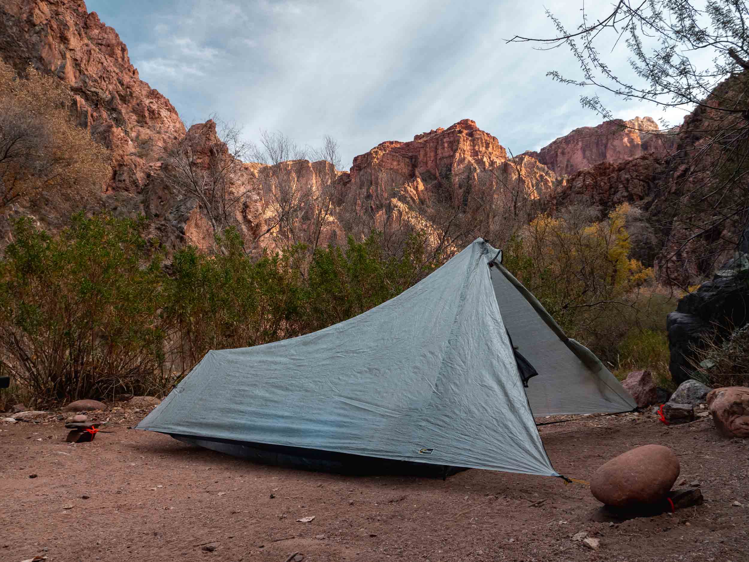
The evening Sun shining down on Phantom Ranch as we made it to camp for the evening, and my Tarptent Protrail Li setup at the bottom of the canyon.
A quick walk to and from Phantom Ranch Canteen, and we had our meals in hand, prepped in to-go containers during the COVID pandemic. This meant that we had privilege of savoring steaks, a baked potato, broccoli, and an iced tea, sitting at a picnic table next to a wall of red canyon rock, the sounds of a stream in the background, and the South Rim looming in the sky above. It was a truly unforgettable moment.
It was a truly unforgettable moment.
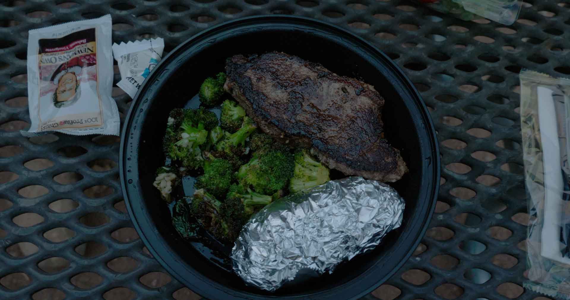

Tyrel and I enjoy our steak dinner. (still frames from the film)
DAY FIVE
This was our last day in the canyon. We’d hiked down from the South Rim four days earlier, and today, we’d be returning. But instead of following the South Kaibab Trail as we had on our way down, we’d instead hike up the legendary Bright Angel Trail. About 9.5 miles of sloped and stepped dirt stood between us and the end of our adventure.
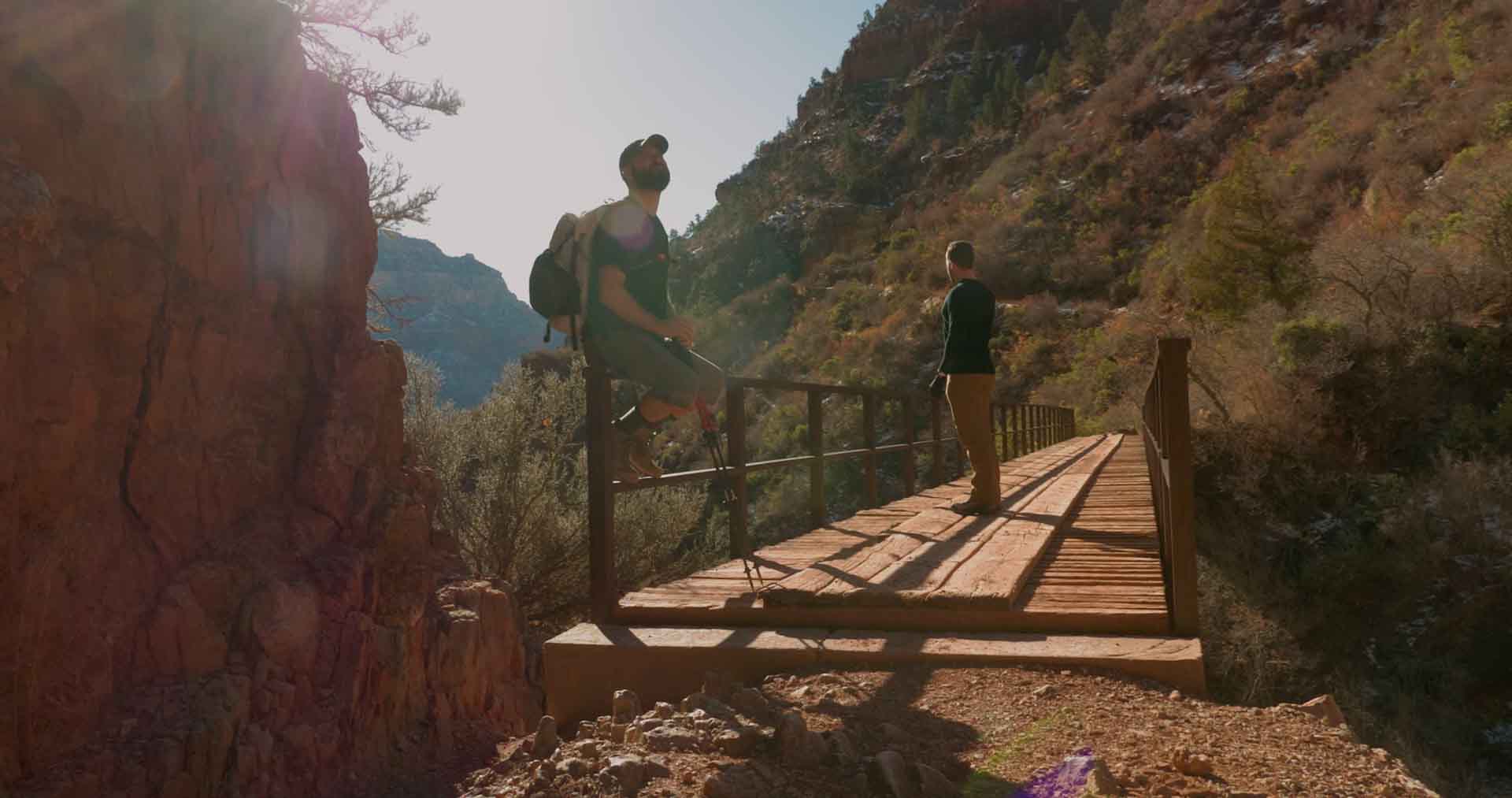
With our gear packed, we left camp and the entire Phantom Ranch area behind. And just a few hundred yards down the trail we neared the creatively named Silver Bridge. This suspension bridge carries hikers over the Colorado River on a metal grate walkway. As we crossed this 524 foot span, it’s walkway gently swaying back and forth suspended from the cables above, we paused to look down at the flowing blue water about fifty feet below and take in the staggering views of the canyon’s walls stretching out in the distance on either side of the water. And then we continued onward.


Leaving camp, nearing Silver Bridge, crossing the bridge, and looking back toward the Phantom Ranch area after making it across. (still frames from the film)
The trail wound back and forth and up and down following the river for a little over a mile. Then, we turned left, away from the river and deeper into the canyon. It was at this point that we began what would be a constant uphill climb to the South Rim. The first notable section of the trail was The Corkscrew, a series of switchbacks ending with a long continuous and gradual curve to the right, forming almost three quarters of a circle reminiscent of those highway on-ramps which never seem to end.
Over the past few days, I had adopted a winning strategy for these long sets of switchbacks: let the mind drift off to focus on the surrounding views while your legs absentmindedly power you towards the sky. This strategy did its job, and soon we were at the top of The Corkscrew looking down on where we’d been thirty minutes prior, satisfied with our progress.


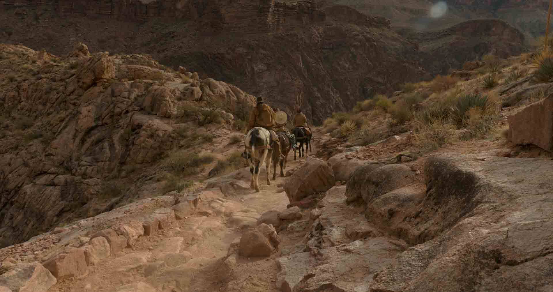
Hiking along the river, turning away from the river to start our constant climb toward the South Rim, looking down on The Corkscrew, and letting a group of mules pass. (still frames from the film)
The next section of the trail carried us next to a stream and the surrounding vegetation it supported. Some deer grazed in tall tan grass off to our right. Soon enough, we came upon a trail sign marking the beginnings of Indian Garden, a small plot of national park buildings and ranger stations. And this is where our day got interesting.
A member of the trail crew, probably about 18 years old with unkempt hair down to his shoulders, olive drab National Park Service pants and a beige t-shirt asked us to keep a wide berth from a man having a medical emergency on a wood slat bench. However, being the only physicians around, we asked if we might lend a hand. The man in question was keeled over on the bench, intermittently grunting expletives and grasping at his chest. He told us his chest hurt, sending radiating pain into his back and neck, and that his left side felt weak.
The first things that went through my mind were a heart attack and aortic dissection involving the carotids with subsequent stroke. Unfortunately, these sorts of emergencies aren’t well addressed with backcountry first-aid. The man needed a hospital. So, Tyrel borrowed the trail crew radio and requested helicopter evacuation.
What seemed like hours later, but was really probably less than twenty minutes, the sounds of a helicopter echoed through the canyon. We initially couldn’t tell where it was coming from, but then it emerged from the Northeast. And after looping around the Indian Garden area, it set down about a hundred yards away up a hill on a little dirt patch meant for just these sorts of scenarios. Now aided by canyon paramedics and rangers that had ridden down, we rolled the man onto a fabric carrying mat, and each grabbed a handle. I took short steps to avoid clipping the heels of the ranger in front of me as we transported the man up the hill to our left, over some rocks, and under the tail of the helicopter. We lifted on the count of three and shoved the man into the helicopter bay. Once we cleared the rotors, the helicopter lifted him into the sky. We’ll never know what happened to him.

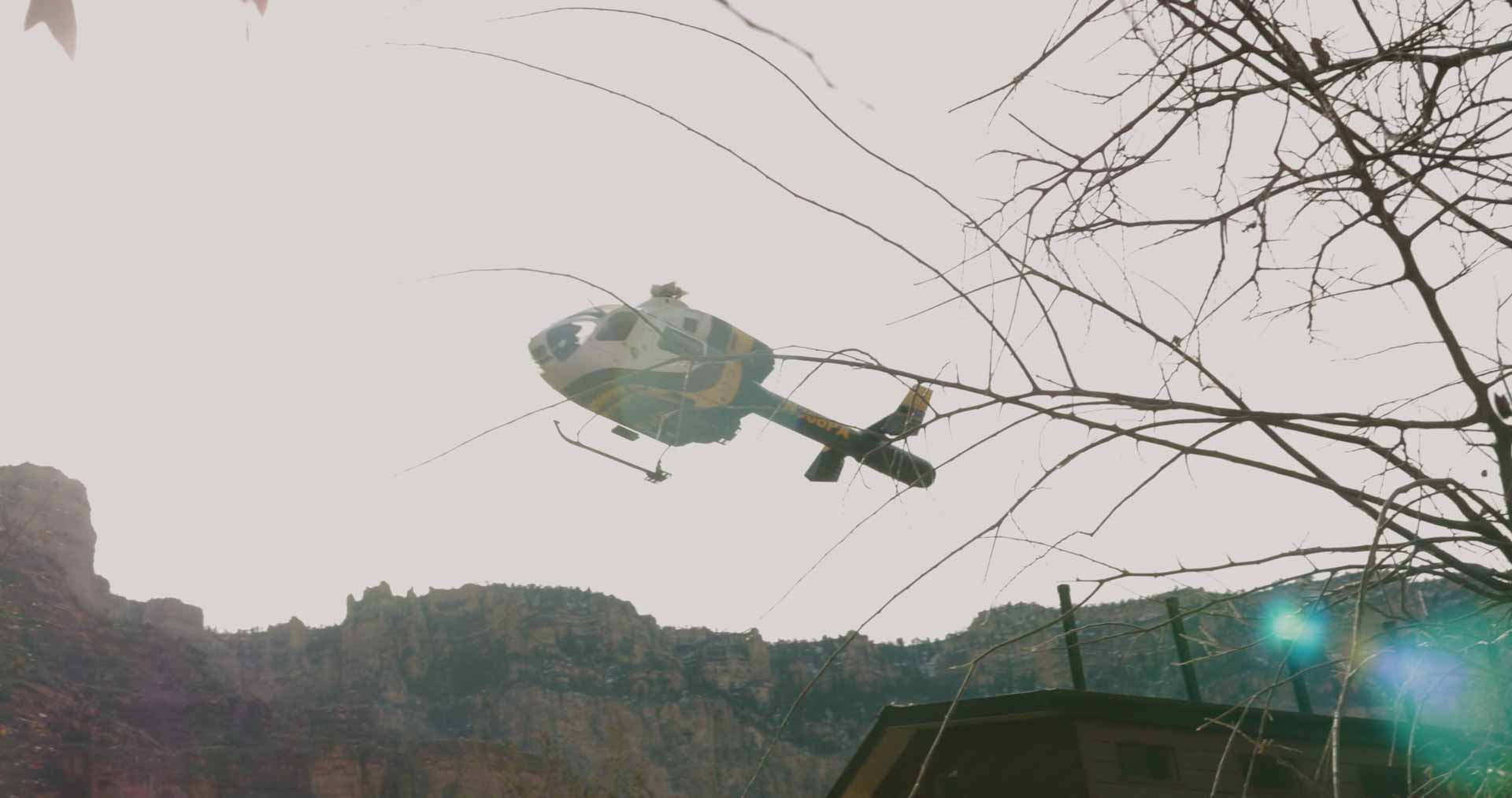


An ECG tracing prints from a Lifepak, the medivac helicopter prepares to land near Indian Garden, we carry the patient to the helicopter, and the helicopter evacuates the patient to safety. (still frames from the film)
Back on the trail after our impromptu medical rescue, we had a slight burst of energy thanks to our adrenal glands. And riding this wave of cortisol and epinephrine as long as we could, we motored up toward the South Rim. The remainder of our path to the top would essentially be sets of closely packed switchbacks connected by longer, more gently folding pieces of trail. Again, I more or less turned my mind away from my immediate surroundings and zone out on the terrain around me.
A couple of miles passed this way, and we made it to the creatively named Three Mile Rest House (lots of creatively named structures throughout the canyon, but at least they’re easy to remember). Here, we briefly got out from under our packs and sat on the stone half-wall at the edge of the little rock structure. Our heart rates calmed as we sat and looked over the canyon below; we had been so far down this morning. And after enjoying some freeze dried fruit, we continued up the switchbacking trail.


Looking up at the South Rim as we continued our hike from Indian Garden, and nearing the creatively named Three Mile Rest House. (photo and still frame from the film)
The next stop would be 1.5 Mile Rest House, and like Three Mile Rest House, we took advantage of the structure’s purpose. Getting back on the trail we climbed the colloquially named heart attack hill and some more switchbacks before the historic Kolb Studio, perched on the edge of the South Rim, came into view. It was at this point that we knew we were really getting close. We were running on fumes at this point, or perhaps the few molecules of fuel left after the fumes had dissipated, carried forward by nothing more than the excitement of completing this epic adventure.
We continued pushing, one foot in front of the other, until finally, we turned a sharp bend around a rock wall and the asphalt of the South Rim walking path came into view. Another hundred yards passed, and we made it. We were plunged back into society, small families pushing strollers, groups of teenagers dressed in hoodies and baggy khakis. The noises of laughter, coughing, kids screaming. And immediately, I missed the silence of the past five days below the rim.


Using what little energy we had left to struggle up the stair-stepping trail, looking down on the Grand Canyon Corridor to the North, Kolb Studio perched on the South Rim, and the last bit of trail before we reached the end. (still frames from the film)
We found a spot off the beaten path to stand on the South Rim and look back North over the entirety of the canyon through which we’d existed for the past five days. And whereas sometimes you need a few days or weeks to reflect on an experience to realize just how amazing it was, I recognized this experience’s significance immediately.
It was, without reservation, my grandest adventure ever.


Looking down on the canyon reflecting on the grand adventure we’d just had, and climbing back on the bus that had delivered us to the South Rim five days earlier. (still frames from the film)