
INTRODUCTION
If you grew up in America, it’s a safe bet that somewhere in the course of your upbringing you were exposed to the idealization of a road trip up the California Coast. This is typically presented as an opportunity to get in a sports car and drive the winding roads of California State Route 1, feeling the perfectly cool California air on your face as you look out at the passing ocean, cross iconic bridges, and make stops in coastal towns immortalized by Steinbeck. In the beginning of 2022, this idealized vision for a drive up the coast of California led me and my parents on a three day trip to experience it for ourselves. At the outset, we knew our experience wouldn’t quite match up given that, instead of a sports car, we’d be riding in my 2012 Chevy Cruze. But still, with what we had planned, we knew it would be an unforgettable experience.
As you continue reading, you’ll see that several of the photos below were taken on my iPhone 13 Pro. I used this trip as an opportunity to test its photographic potential, mainly to see if, in instances where a more bulky camera might be imposing, I could rely on my smartphone to capture images of adequate quality. I’ll let you judge the image quality and editability for yourself, but my key takeaway is this: while the iPhone doesn’t match a dedicated camera with a larger sensor and better optics, using a ProRaw capable iPhone and getting rid of the awful automatic post-processing Apple applies to photos, I’m left with results I’m satisfied with when viewing on small screens. The photos don’t fill me with the same regret I’ve felt when attempting to rely on older generation iPhones. Anyway, back to the adventure!
DAY ZERO
My Dad and I started this journey in Tucson. On the first day of our trip (which I’m calling Day Zero as it was just a day of driving) we would drive to Los Angeles to pick up my Mom from her flight at LAX. There are a couple of different relatively equidistant routes between Tucson and LA, but we opted for the route following Interstate 10 to Phoenix before turning west to Los Angeles, passing Joshua Tree National Park along the way. We set out without much ado, and after leaving the Saguaros of the Sonoran Desert behind, making it through the NASCAR event that is the highway system of Phoenix, and driving through the flat land of western Arizona, we neared Joshua Tree National Park. After five hours of driving, we were in need of a break, so we drove into the park’s southern entrance to catch at least a glimpse of its scenery. We followed the winding road through the small mountains on the park’s southern border to Cottonwood Visitor Center and took some time to stare out at the mountains to the east. And then, almost as soon as we arrived, we climbed back in the car and got back on the highway.
From this point we had about three and a half hours to the Airport, assuming we didn’t get caught in any Los Angeles traffic. Continuing west we saw what I later learned to be San Jacinto Peak on the horizon. This prominent mountain is home to the famous Cactus to Clouds trail. And as we eased down the highway, we began to understand just how big the mountain was; we kept driving, but it never really seemed to get any closer. Eventually, we neared the mountain’s base just a few hundred yards or so of the highway to our left, with a windmill farm between us and it. And as I risked glimpses away from the road up at what I could see of its peak, I swore to myself I’d come back one day to hike to the top. I then looked down at my fuel gauge. Seeing that it was nearing empty, we pulled of the highway to get gas, giving me a proper opportunity to stare up at San Jacinto.
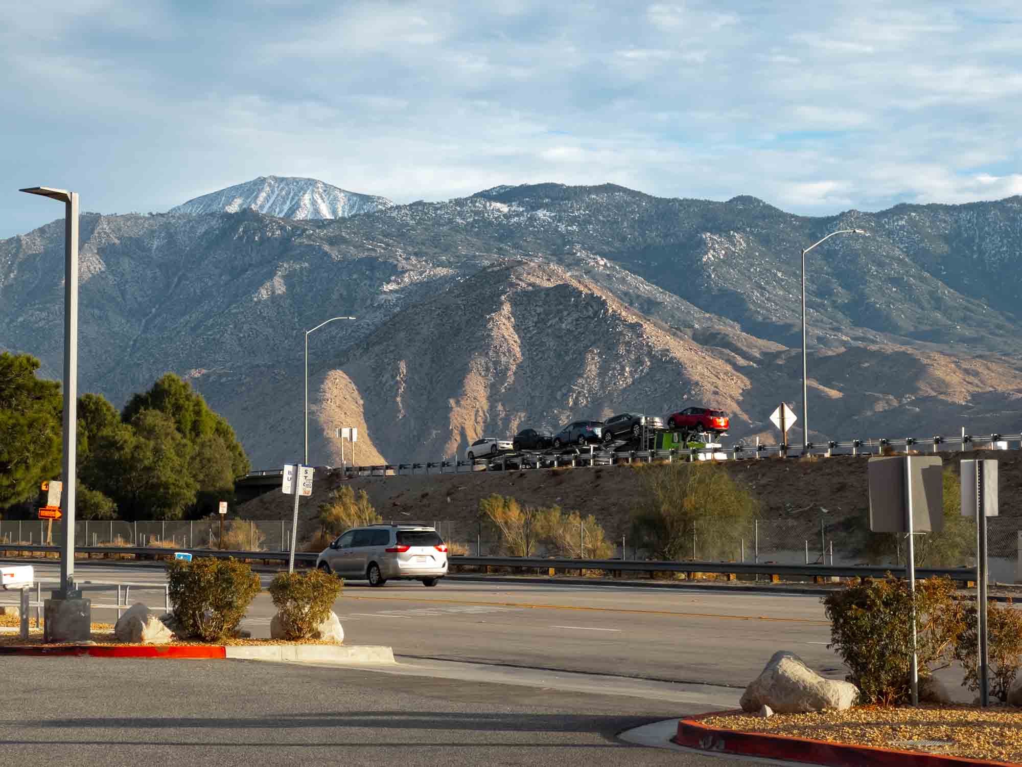
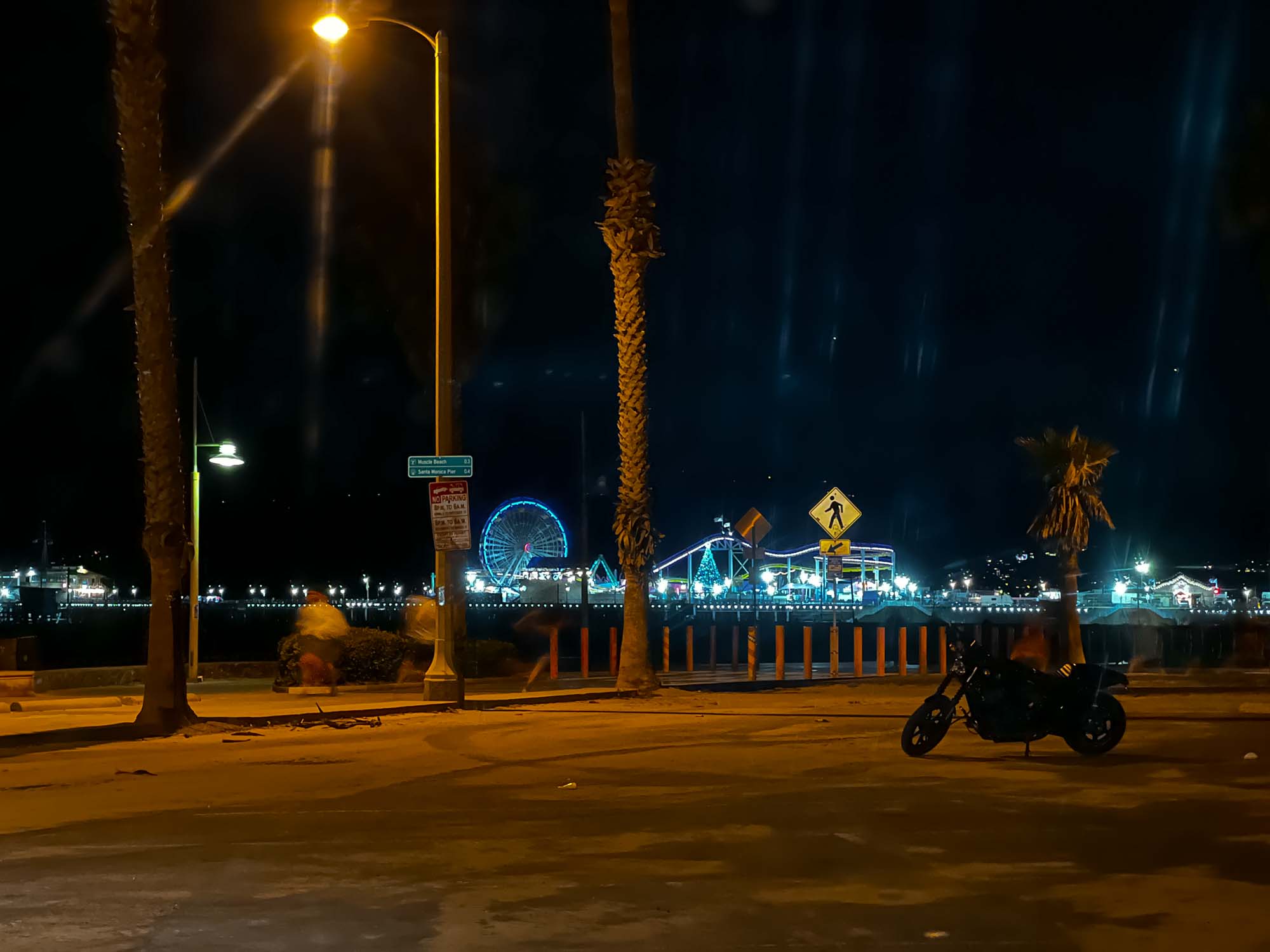
The view of San Jacinto from a highway gas station, and a quick stop at Venice Beach on our way to LAX | iPhone13 Pro
At this point, the Sun was low in the sky out the windshield in front of us, with just enough light left to help us to navigate a particularly curvy section of road without relying on headlights. A quick stop at a chic fil a kept our stomachs full, and not too long after, we were left in the dark as we approached the heart of LA. It wasn’t rush hour, but I still got a taste of driving in LA. Priuses merged onto the highway from the right going thirty miles per hour under the speed limit, while Dodge Challengers zoomed past on the left going thirty over.
I simultaneously felt impeded and in the way. I suppose the upside is that no matter how you drive, you won’t stand out; other people on the road expect chaos. Anything goes.
Eventually, we survived our way to the airport. And after waiting in the cell phone waiting lot for about thirty minutes, we picked up my Mom, drove slightly north of town to Camarillo, and stayed the night in a Hampton Inn.
DAY ONE
After a good night’s sleep, we loaded into the car and drove a bit north to Santa Barbara. What struck me immediately along the drive into the city was the uniformity of the architecture. It seemed that every building was painted white with a deep red roof in a Spanish Revival style. Such cohesive, albeit strict, city planning does add something to the character of a city and the experience of a visit. We parked in a small parking garage near State Street and spent some time walking up and down the sidewalks perusing shops and eyeing restaurants. The weather was stereotypically perfect, with the Sun beaming down its warmth, and a breeze off the ocean keeping us cool. It was a quiet morning. Buses released the pressure of their airbrakes several blocks down the street, birds flew overhead, and water trickled from hoses used to hydrate flowers in large concrete pots at the street corners.
Gentle hums of conversation radiated out the eateries tucked back through doors under covered walkways. After about an hour our walk brought us to the coast where State Street continues over the ocean as Stearns Wharf. The ocean breeze was even greater here. We strode over the thick wooden planks gradually worn and smoothened by footsteps, and eventually came to a seafood restaurant named the Santa Barbara Shellfish Company. We got a table outside at the edge of pier looking out at the water and ordered lunch. On the menu for me was a lobster roll with fries and a beer, a lunch that’s hard to beat.
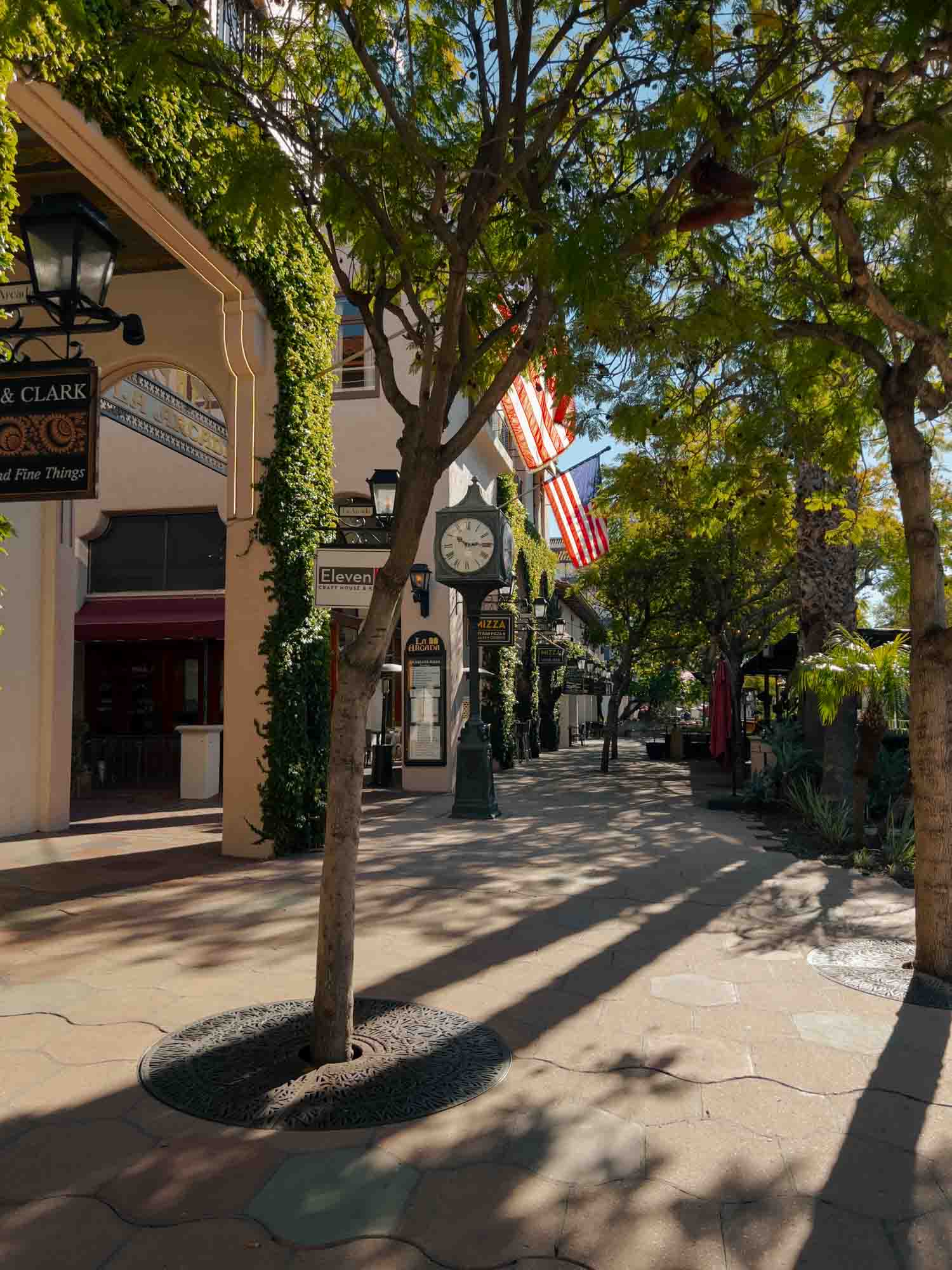
The streets of Santa Barbara | iPhone 13 Pro
With our stomachs full, we walked off the pier and down onto the sand for a stroll along the beach. The ocean to our right was calm. To our left, skateboarders tried out new tricks in a small skatepark and people ran and rode bikes down a park-side path under palm trees. We walked for a while before turning around back toward State Street, and then to our car. It was early afternoon and we were off to Pismo Beach.
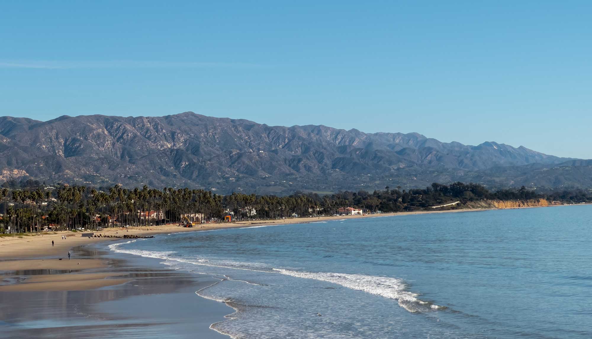
The beautiful beach from the pier where we ate lunch | iPhone 13 Pro
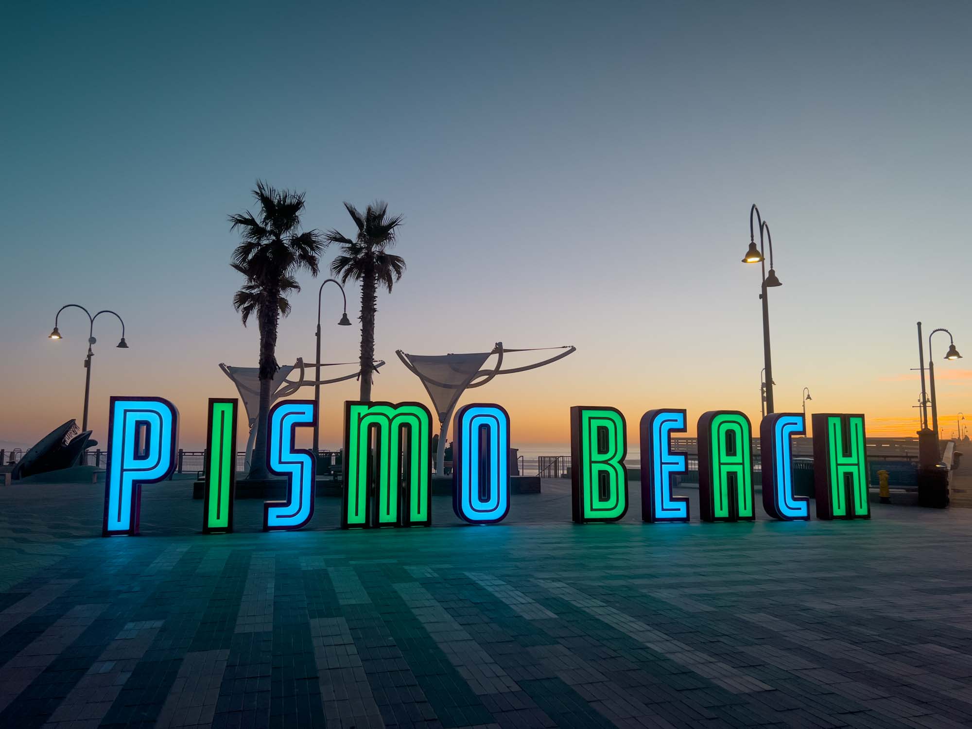
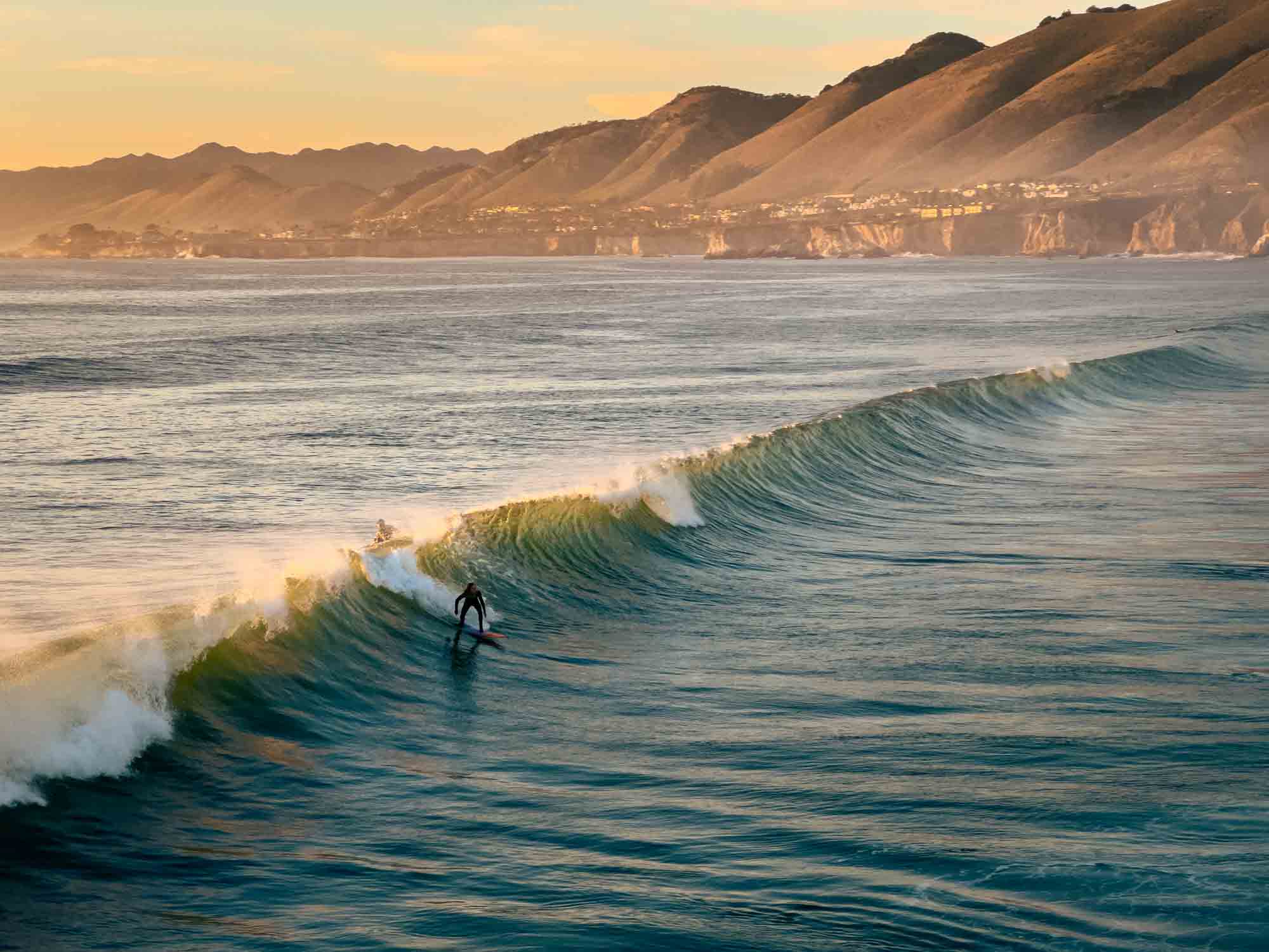
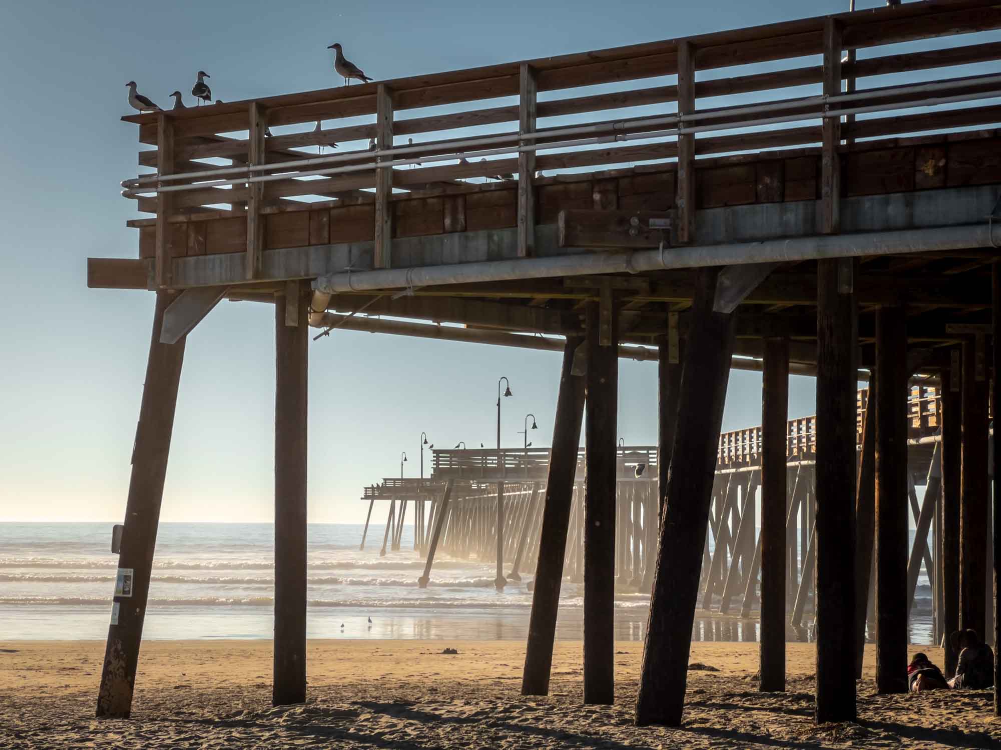
After a couple more hours on the road, we pulled onto a street near Pismo Beach, parked on the curb next to a group of restaurants and souvenir shops that shared walls, and walked two blocks toward the coast to get to the beach. We knew we were in the right place when a group of man-sized letters glowing in cycling color schemes spelled out P I S M O B E A C H. They sat on a large open park-like area leading to our second pier of the day. We slowly walked out to its end, taking the time to watch surfers forty-or-so feet below try their luck bobbing on the surface waiting for waves. When a wave would finally form, the low Sun would cast its crest into a golden hue as the surfers scrambled to catch it.
We walked back to the beginning of the pier and down a set of stairs to the right that led us onto the sand. This was probably the widest beach I’d ever seen, with a good hundred or so yards of sand between us and the ocean. We walked under the pier off to our right and enjoyed another walk on the beach until it was gradually forced to narrow to a point by water and cliffs. As we turned around and walked back toward the pier, the sun set over the water to the west. We climbed back to street level and found a spot for dinner at a pizza shop before again driving to a Hampton Inn and getting some sleep.
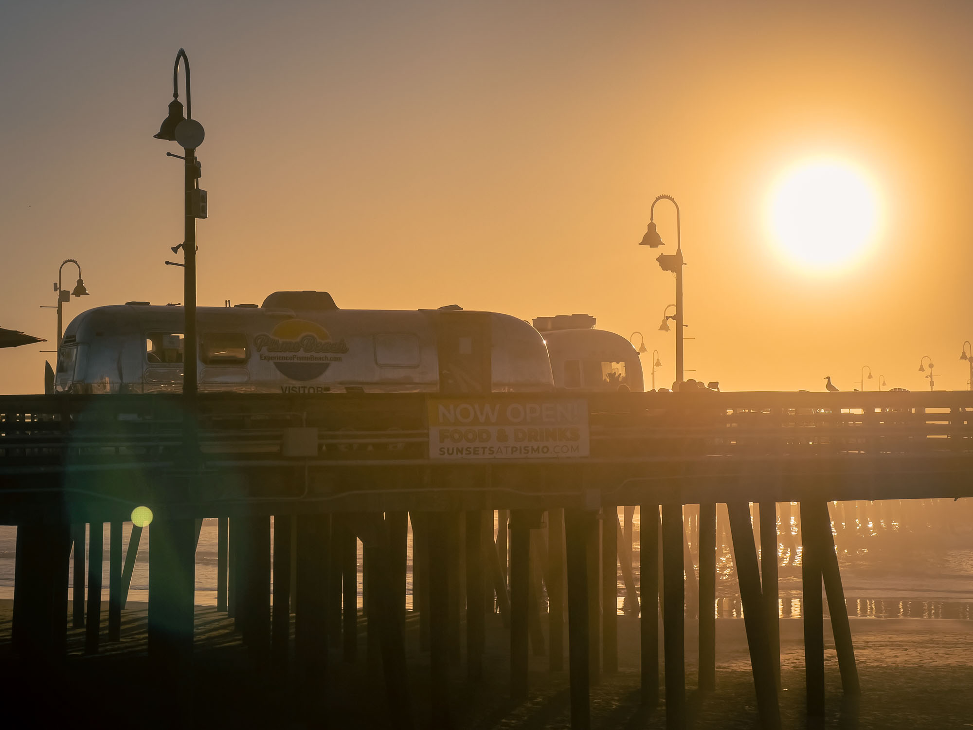
Our jaunt around Pismo Beach | iPhone 13 Pro
DAY TWO
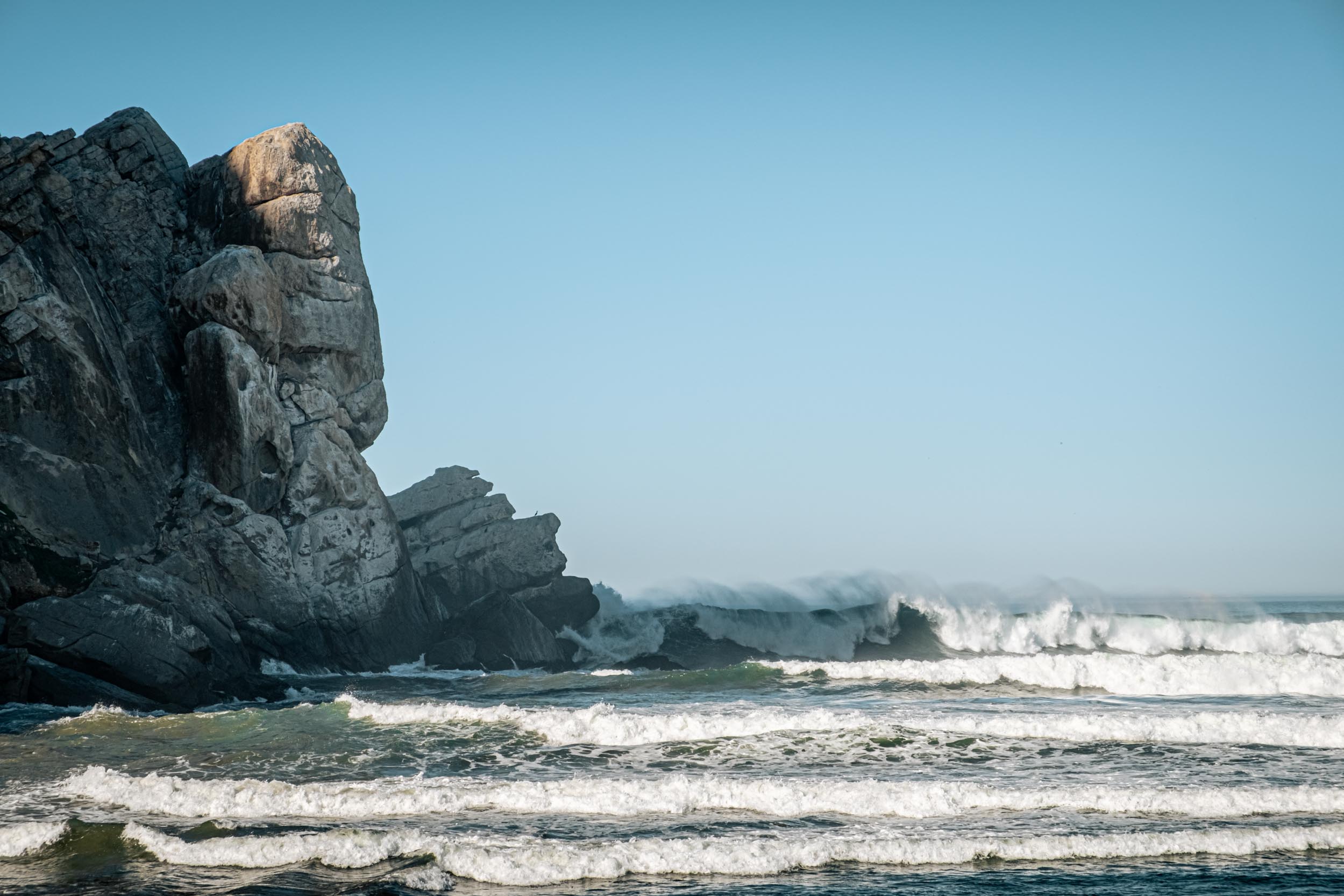
We woke up refreshed and ready for day two of our trip up the coast of Southern California. Again, we loaded into the car and joined the highway for a short trip north. Pulling off the highway, we drove through a few blocks of the small coastal town of Morro Bay and then onto a road that followed the coast taking us past a few water-side restaurants and docks with boats bobbing on the surface of the ocean to our left. Out the windshield Morro Rock stood prominently with a dome-like shape projecting almost six hundred feet into the air. Its rough brown surfaces curved downward and plunged into the water, with waves forever crashing onto them.
And extending from the base of the rock to the north was a first rocky then sandy beach that must’ve stretched for a mile, maybe more. We pulled up to a parking spot just on the backside of the rocky portion of the beach, just a few hundred yards from where Morro Rock projected out into the ocean. And from here we walked up and down the area watching the ocean send sometimes small and sometimes huge waves crashing and curling about the rock’s base. Like the day before, and all the days after, the sun warmed and the ocean breeze cooled, keeping us in a pleasant state of homeostatic perfection.
Watching the waves crash at Morro Bay | Fuji X-H1
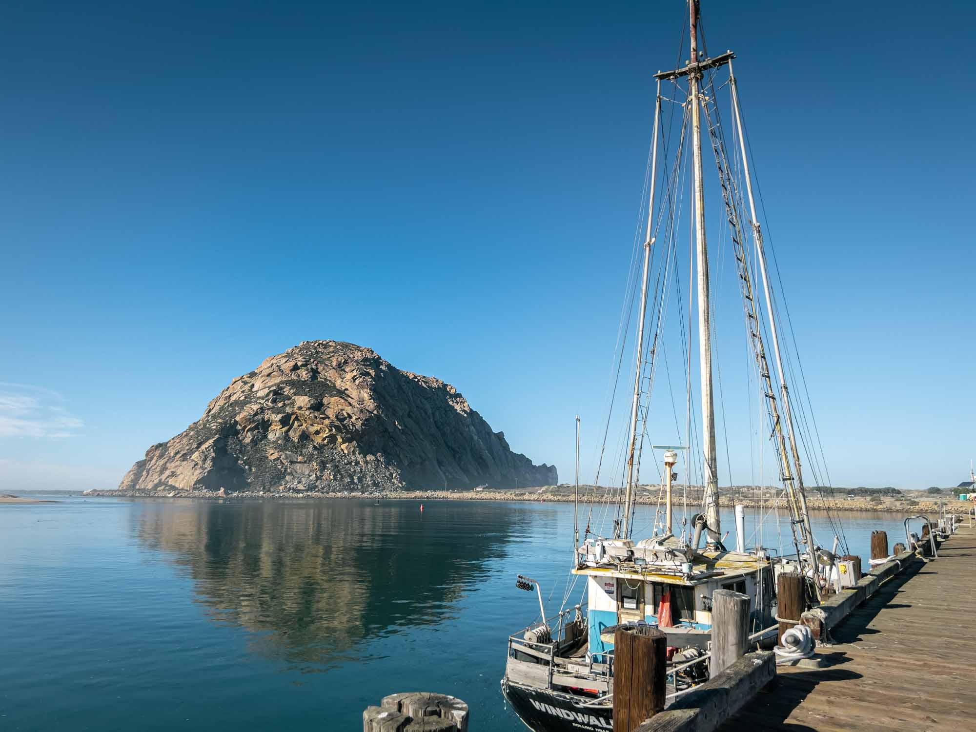
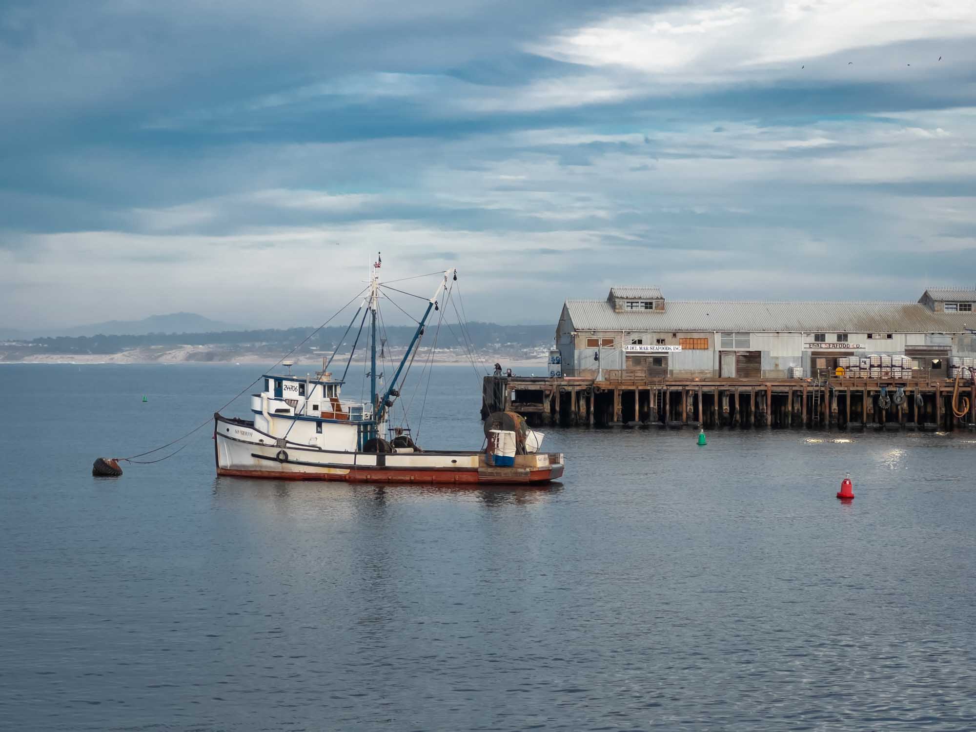
After a while of watching the waves roll in we got back in the car and drove to the docks and bobbing boats we’d passed on our way in. We got out and walked between the buildings on the water’s edge and then onto the wooden planks that, like the piers we’d explored in Santa Barbara and Pismo Beach, had been worn down by decades of foot traffic. But unlike those piers that had projected straight out over the ocean, these were arranged in a “T” shape. On the inner edge of the left arm of the T stood an antique sailing ship, with a ship from WWII floating on the outer edge.
On the right floated some coast guard vessels being cleaned by their crews, and an old fishing boat. Outside of this Coast Guard crew, we were the only people around; we had the docks to ourselves. And with several previous visits to California having been marked by constant overwhelm from the sheer number of people, seeing these more relaxed and less congested parts of the state helped me understand its appeal.
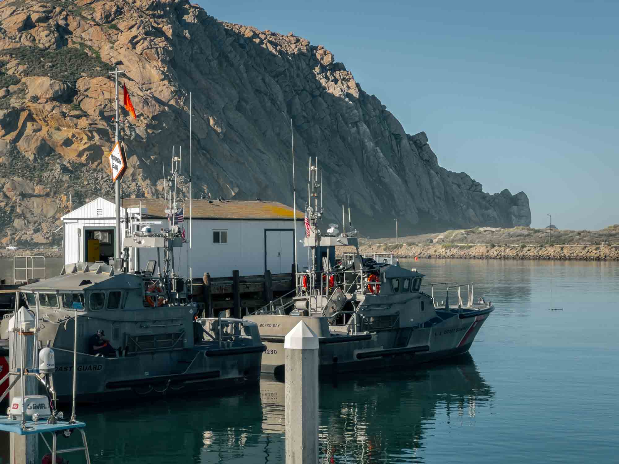
Views from the docks at Morro Bay | iPhone 13 Pro
Back on the road, we continued north up Route One. It took us away from the coast for a bit, with some hills on our left between us and the ocean. To our right were plots of land used for farming or perhaps wine making. And before too long we rejoined the coast and continued along the ocean until we neared Piedras Blancas. To our left was a small gravel parking area with a sign demarcating a seal viewing area. A path led from the parking lot down along the coast overlooking a brown sandy beach sitting at the base of some cliffs.
And on what seemed like every square foot of that beach were elephant seals. HUGE elephant seals. We leaned on the wood fence along the path and watched them for a while, lucky enough to catch a location dispute between two males that led them bounding into the ocean, swinging their necks into one another to drive their long teeth through the other’s thick grey-brown skin. Eventually, the dispute was settled and the loser found a new spot to bake in the sun.
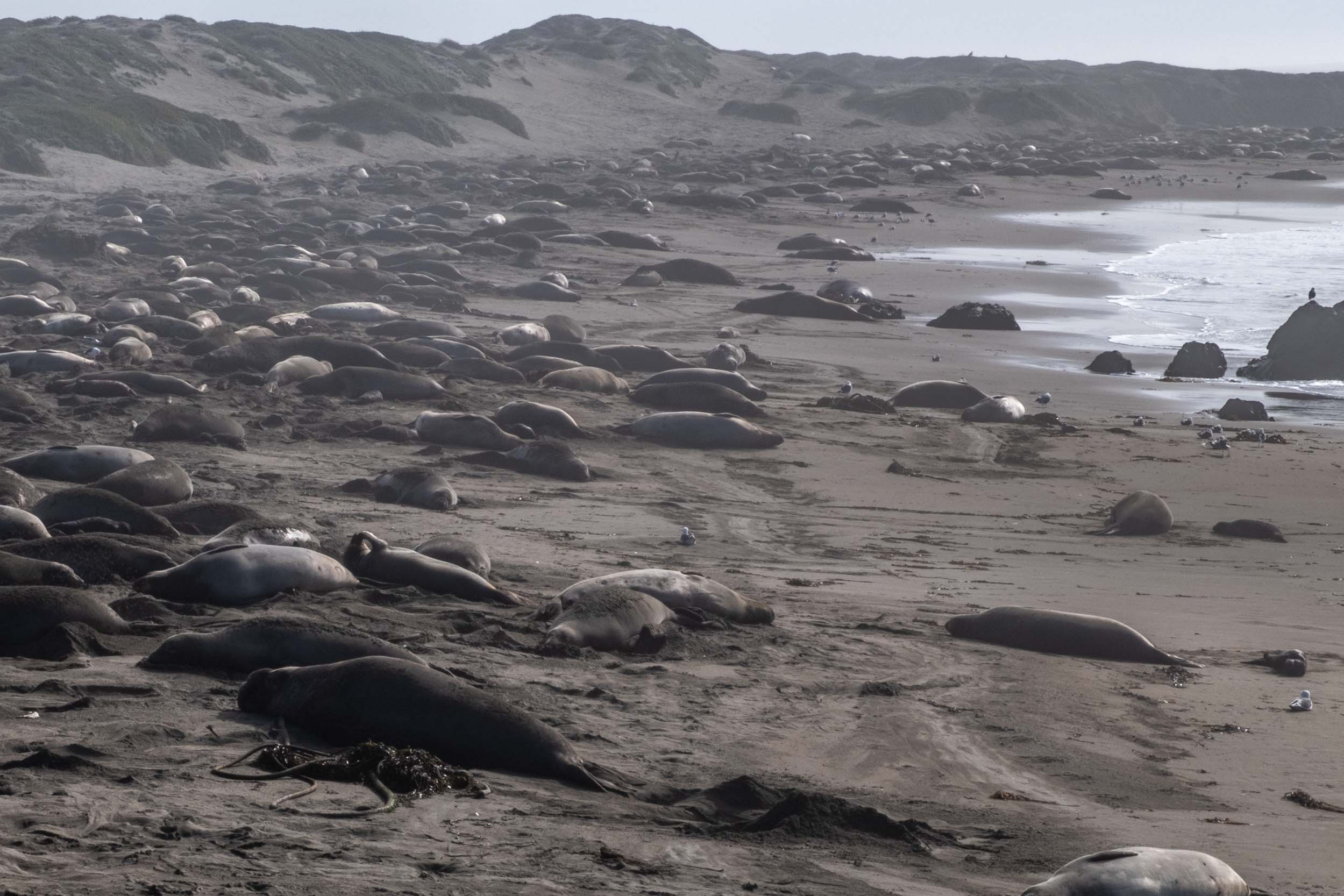
The Elephant Seal viewing area | Fuji X-H1
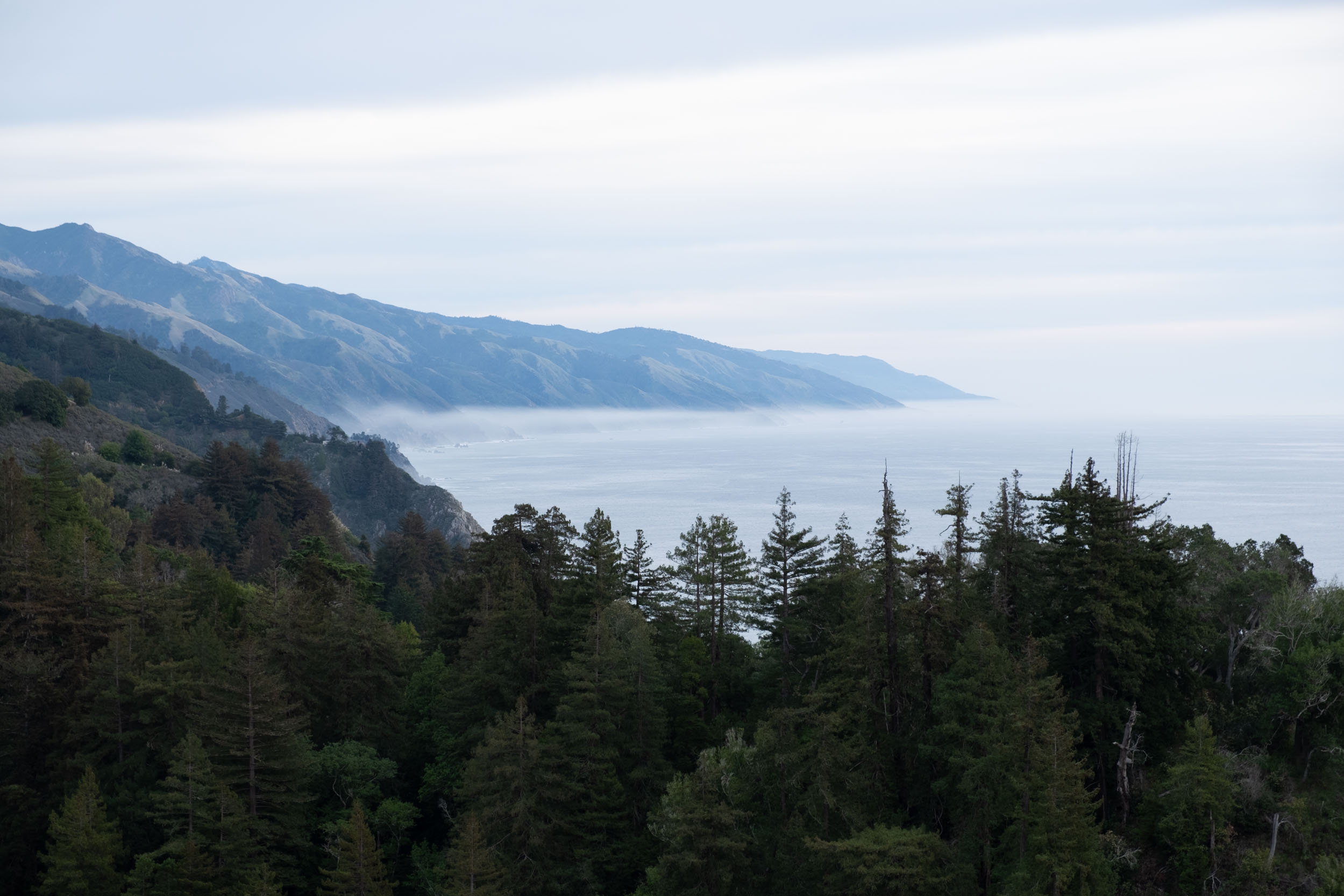
We walked back to the car, and again drove north. Soon, we entered Big Sur. This region of coastal mountains descending into the ocean has been immortalized in countless photographs and movies, and I was excited to finally explore it. We wound back and forth following the highways carved into the mountains’ rocky projections, and eventually made it to the parking lot for our first stop in Big Sur: McWay Falls. A trail led us down some stairs, and through some trees and through a tunnel and on the other side of the tunnel we emerged to the viewing area we were after.
A few hundred feet down was a small area of beach surrounded on three sides by towering cliffs, one of which supported the trail we were on. Its fourth side faded into the ocean. From one of the cliffs opposite us, a small stream sent water over the edge crashing onto the beach surface below, forming McWay Falls. Off the beach a bit was a small rocky outcropping covered by trees. Gulls called overhead. All of these features combined to create a perfect little slice of Earth. And thankfully, they’ve made this beach off limits, meaning that it might actually be preserved in this pristine state for future generations.
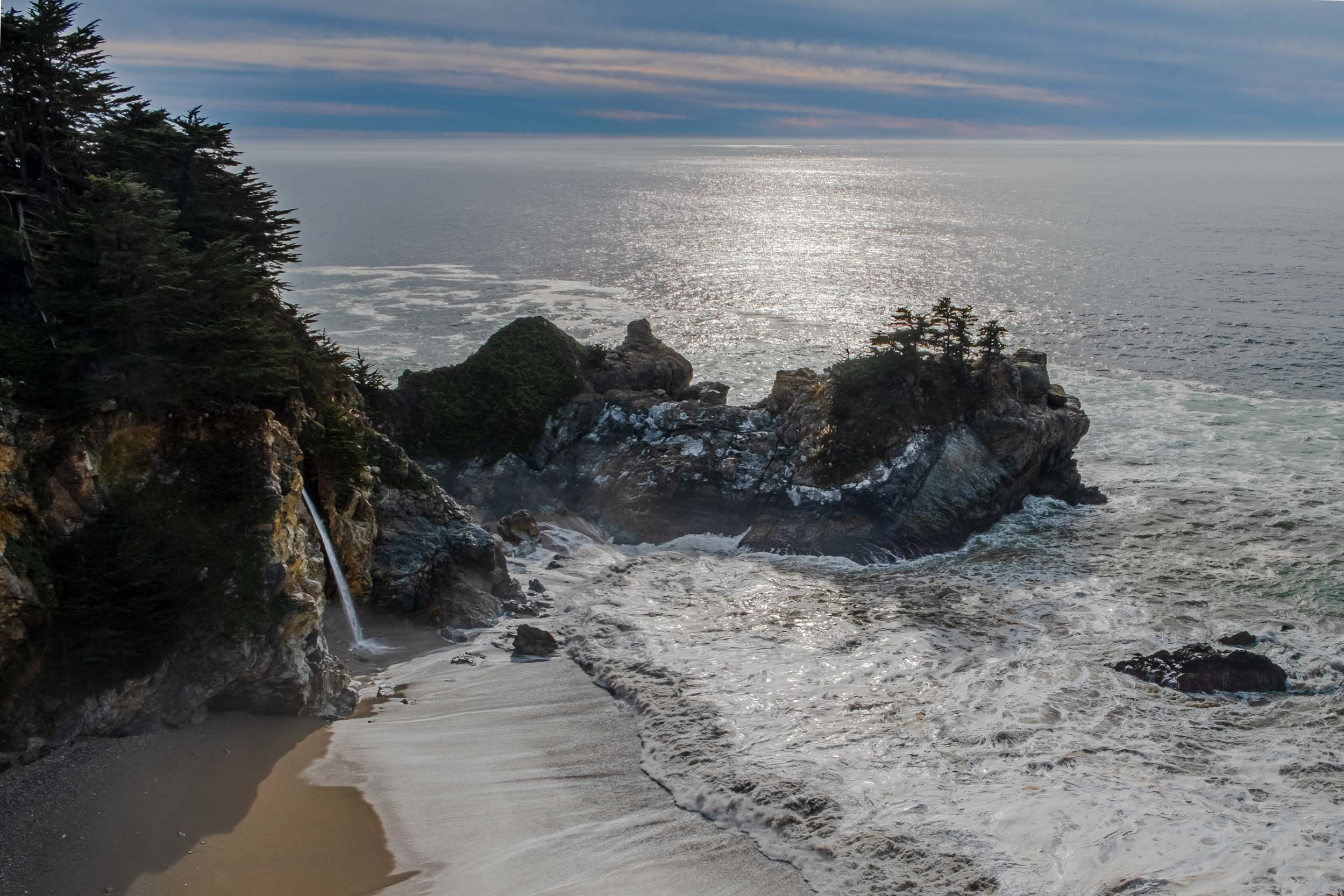
McWay Falls | Fuji X-H1
At this point we were getting a bit hungry, leading us to our next stop: Nepenthe. This restaurant is an icon of the area, perched atop a peak overlooking the entirety of Big Sur to the south. I parked my Chevy Cruze next to a silver Porsche 911 Turbo, and we walked up several flights of concrete stairs ascending through the trees to get a table and grab a bite to eat. The food was good but the overall experience was unforgettable, looking up from our meals at the tree-covered mountains down the coast and endless ocean to the west. For the first time on our trip, clouds filled the sky and blocked the sun preventing us from baking in the sun while eating. After browsing the small gift/book shop at the base of the restaurant we continued down the road.
The view from Nepenthe Restaurant | Fuji X-H1
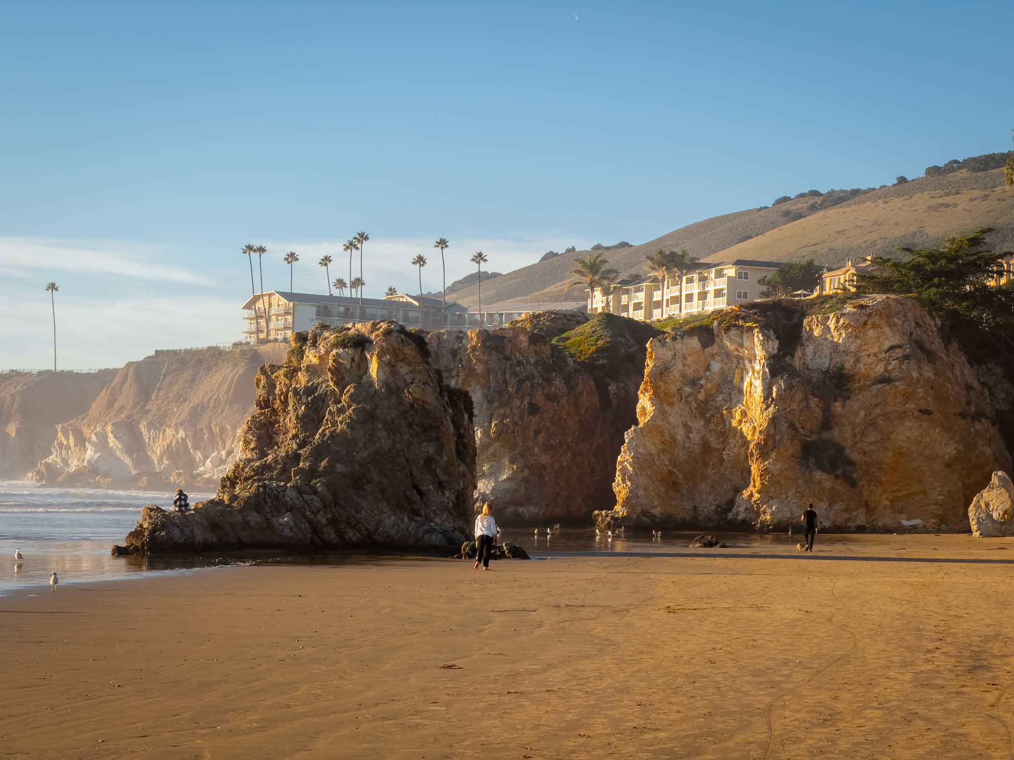
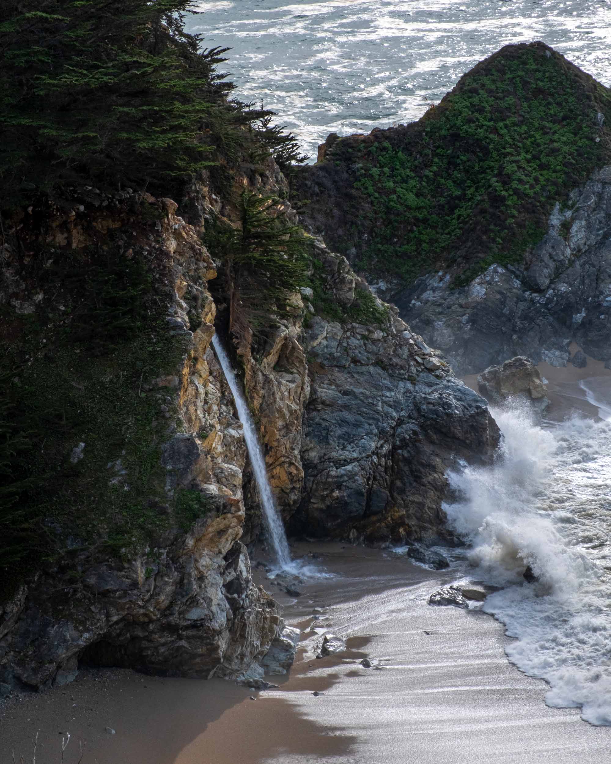
We soon pulled off again to visit Pfeiffer Beach. The road to the beach area is a small one lane affair, requiring you to pull off to the side intermittently to let cars driving in the other direction pass. Both sides of the road are bordered by tall dense coniferous trees that block the sun and contribute to a “dark forest” vibe. With no visual variety, this road seemed to go on forever. Luckily the Chevy Cruze, or Chevy Rubicon as I like to call it in these sorts of situations, handled admirably and soon we pulled into a parking area under a large Sargent Cypress tree. The clouds that had rolled into the skies while we ate at Nepenthe were still present, casting everything in a cool humidity. We walked to the end of the parking lot toward the coast, down a small path, and emerged past some trees on the beach. And what we saw made the questionable drive down well worth it.
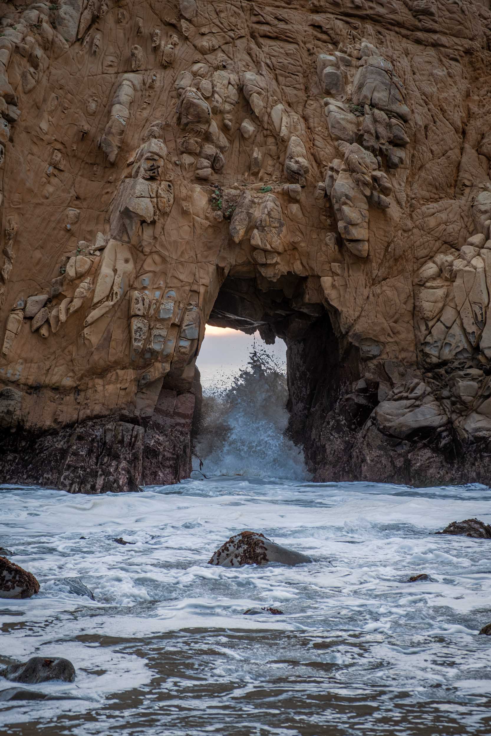
To our left, cliffs descending from the mountains met the sandy beach at their base. This beach stretched for a few hundred yards to our right before being interrupted by a small dome-like rock formation like a miniaturized version of Morro Rock. At its center was a cave carved over time by crashing waves, through which you could see the horizon. A gull perched on a smaller rock presumably looking for a meal. The beach continued around a bend in the cliffs at our right flank and curved out of view. The clouds in the sky were interrupted just above the horizon, giving us views of the sun planning to set in a few hours. Ocean waves crashed all around us, as they always do on beaches, filling our ears with their pleasant soundscape. We walked and sat and admired the beauty around us for sometime, but then, it was time to head on.
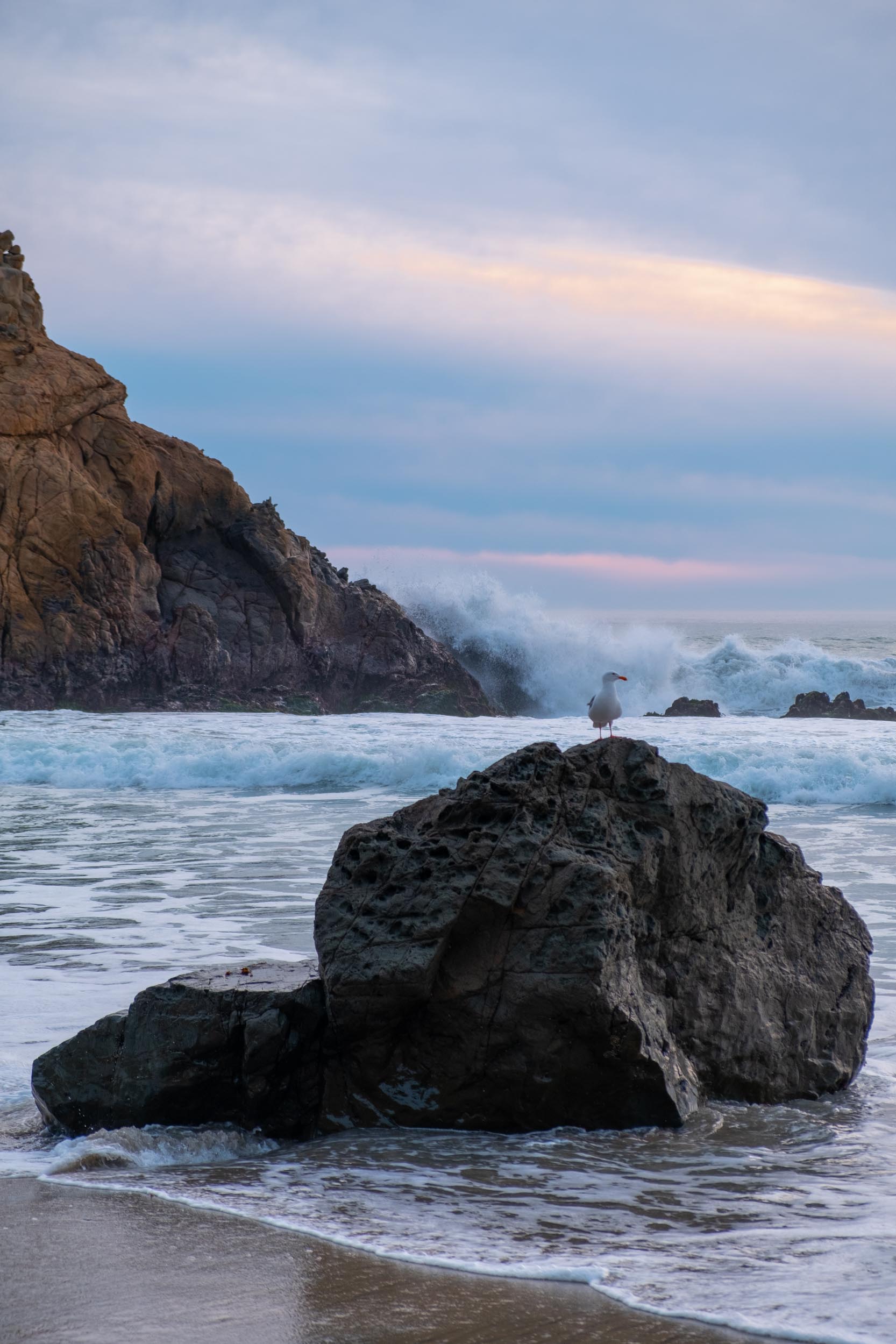
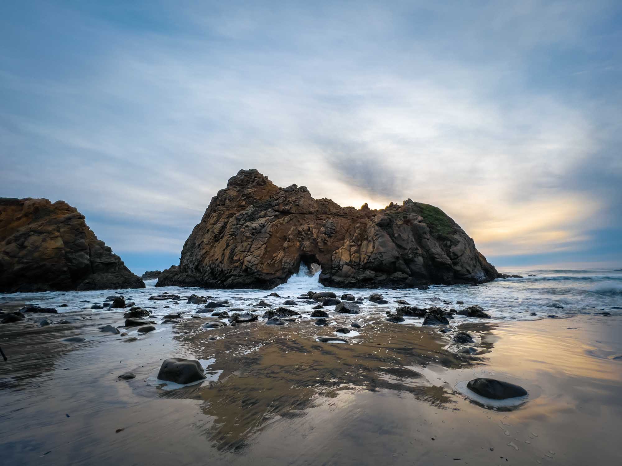
Pfeiffer State Beach | Fuji X-H1 (top three), iPhone 13 Pro (bottom)
After reversing course on the one lane forest road, we rejoined the highway and continued to our next stopping point: Bixby Bridge. Another Icon of Big Sur, we stopped in a small parking area at its distal end to get some photos and admire its engineering for a bit. And then we continued on to Monterey for another night’s sleep.
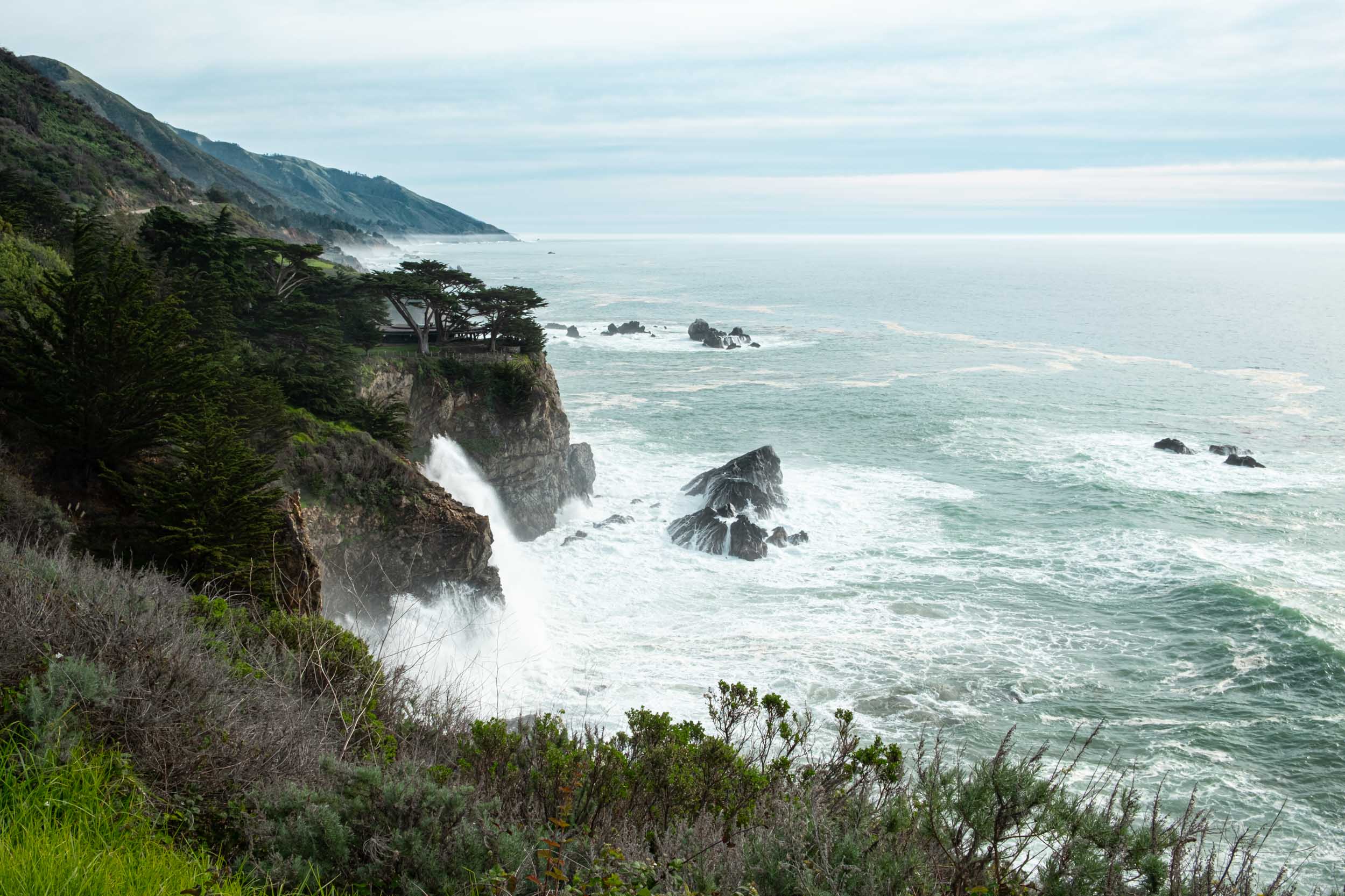
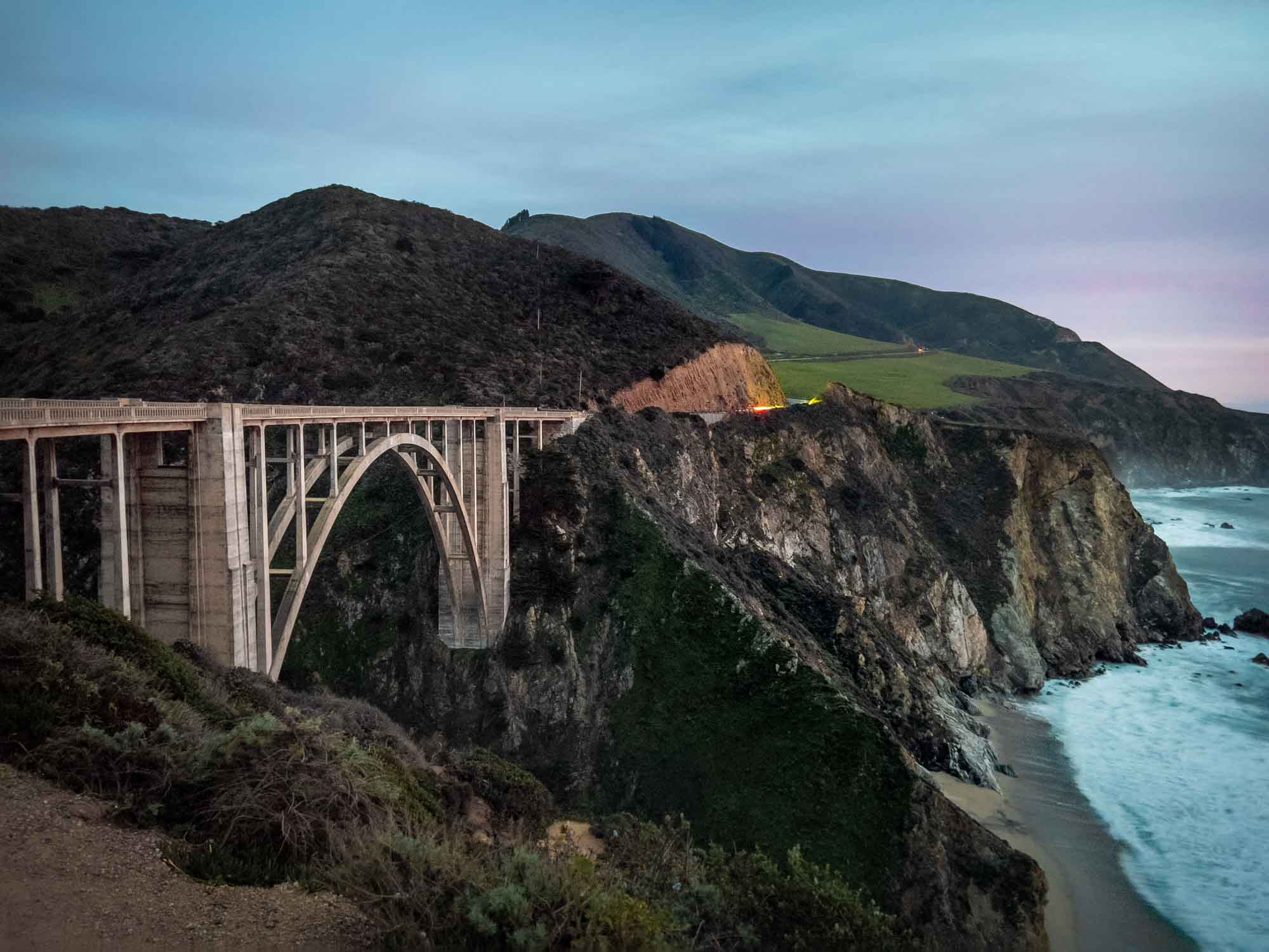
Views along Route one on the way to Monterey | Fuji X-H1 (top), iPhone 13 Pro (bottom two)
DAY THREE
We woke up in Monterey, and unlike the previous two days, wouldn’t spend this day driving between destinations. Instead we found our way to a parking garage near Cannery Row and spent the day exploring on foot. We walked a couple of blocks toward the coast to the relatively small section of road that comprises Cannery Row. For those that aren’t familiar, this little waterfront street was once named Ocean View Avenue and was a site of many sardine canneries. Steinbeck published his novel named “Cannery Row” in 1945, and later, the street was officially named Cannery Row.
Given its history, this area is marked by an early 1900’s industrial character with old two story factories on either side of the road, since renovated to hold shops, restaurants, hotels, and the amazing Monterey Bay Aquarium. We walked up and down the road visiting these establishments, browsing the shops, and eventually settled in for lunch at Louie Linguini’s. Because it was January –not exactly peak season for tourism in Monterey– we were the only people in the entire restaurant. Subsequently, the service was great.
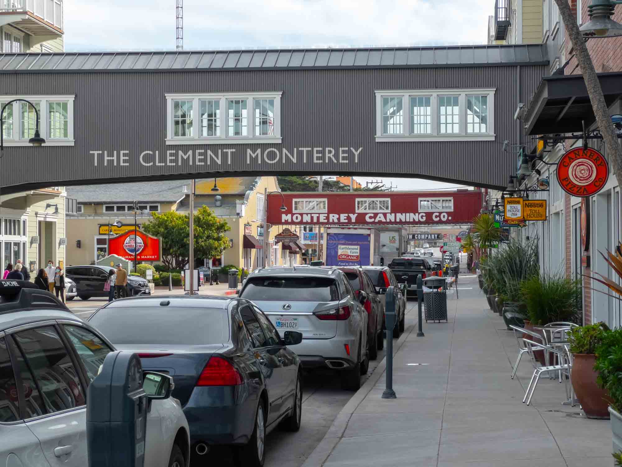
Cannery Row | iPhone 13 Pro
After lunch we made our way down the road to the remodeled Hovden Cannery which now housed the Monterey Bay Aquarium. Its relatively humble façade concealed its true size and tempered my expectations, but once we were inside I was overwhelmingly impressed. The remodel and expansion of what used to be a sardine cannery had been done tastefully. Certain sections of the historic location were left intact, allowing patrons to view old portions of the old cannery’s brick walls and piping. The rest, however, was a completely modernized set of spectacular exhibits letting us view marine life from the sandy shore to the deep sea.
Penguins walked about in large enclosures and sea otters floated on their backs between jaunts below the surface. I was particularly struck by the simpler organisms of the deepest and darkest parts of the oceans. Jellyfish and Sea Angels floated about in large tanks with indiscernible boundaries such that when you peered into them, it was as if the creatures were floating in space. As we walked into the open ocean exhibit, a tank of water shaped in an oval hung over our heads creating a ceiling of fish swirling around us. To put it concisely, if you’re ever in Monterey the aquarium is a must-see.
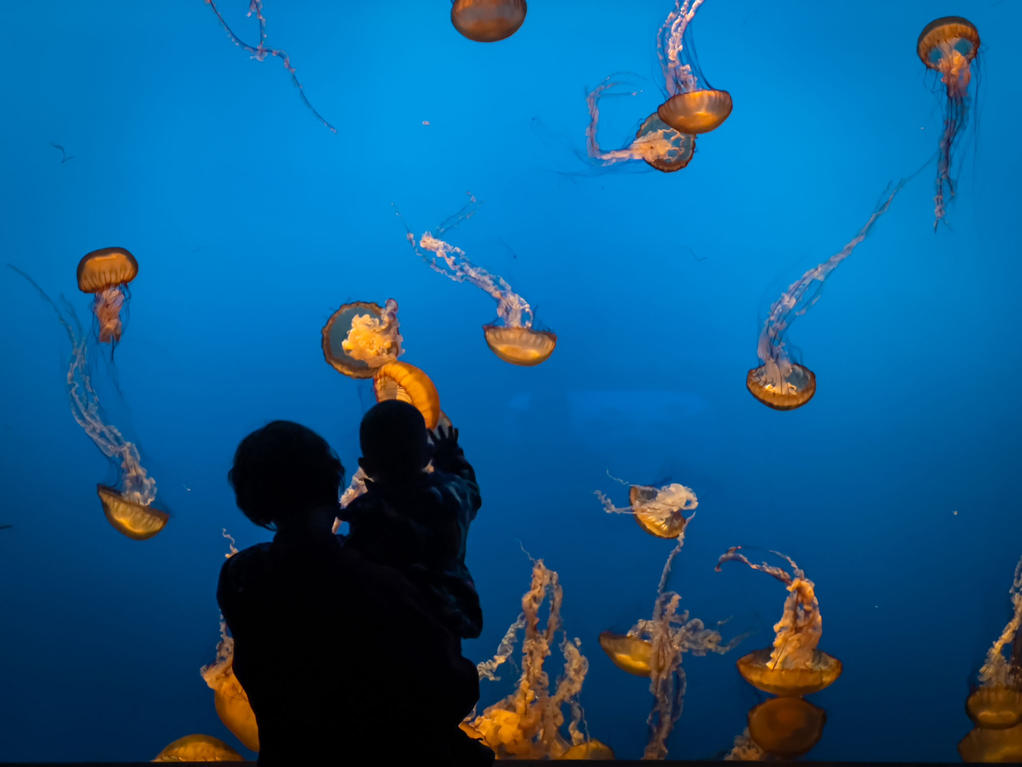
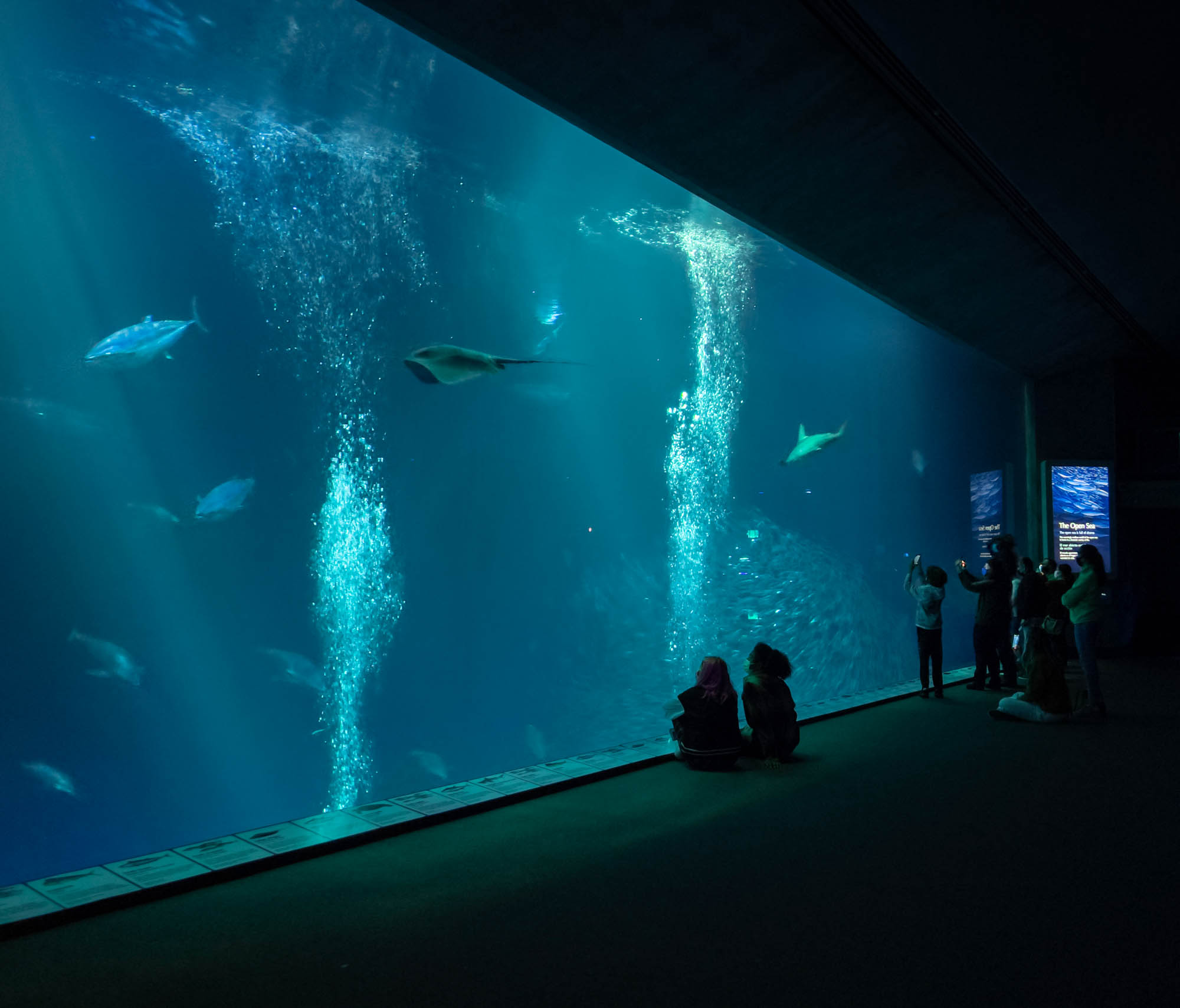
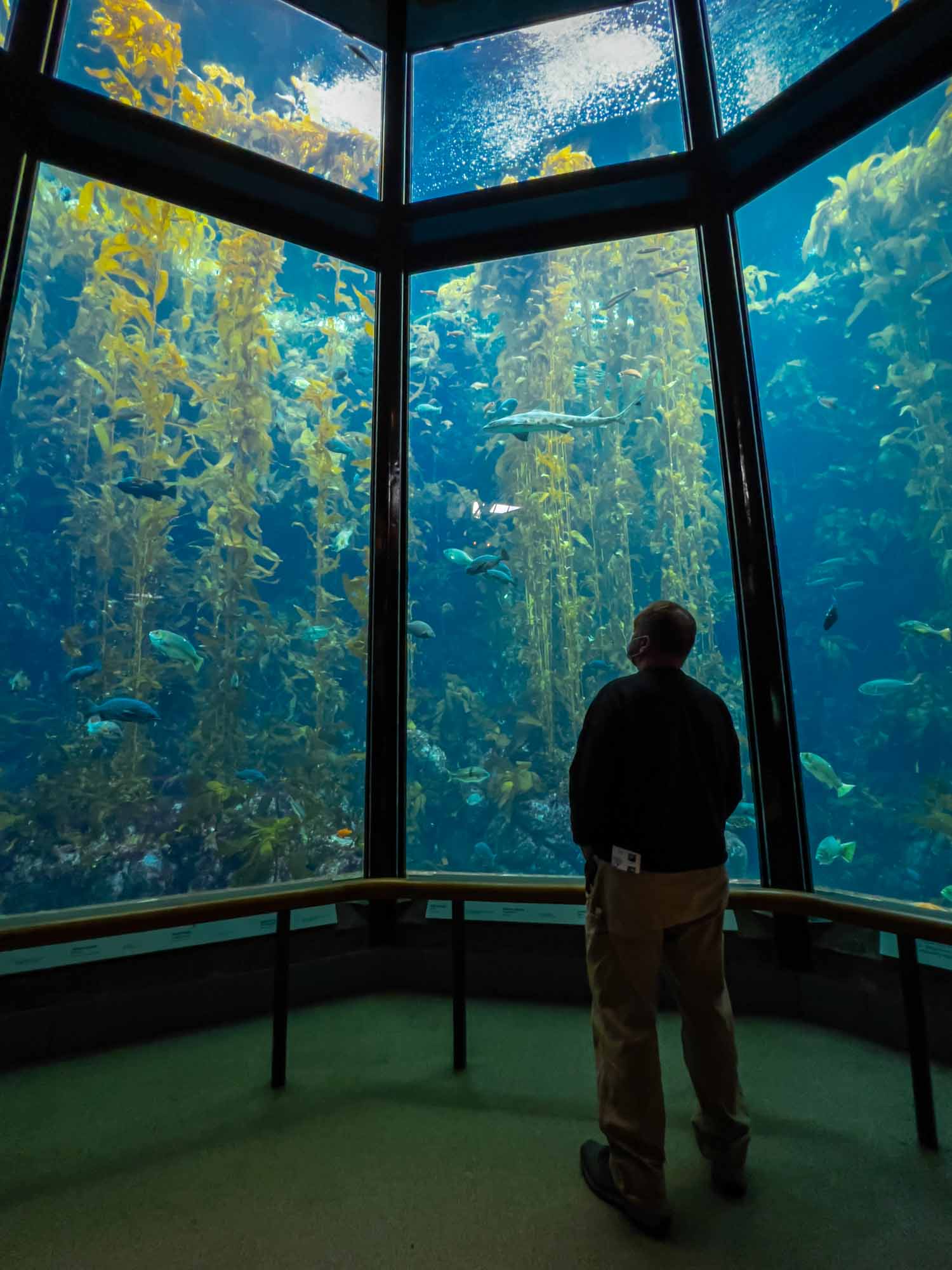
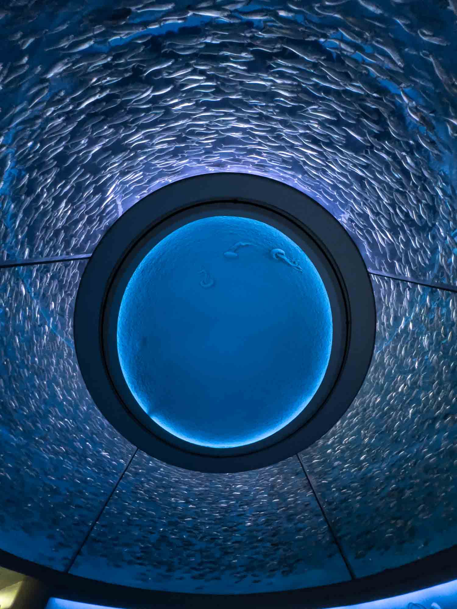
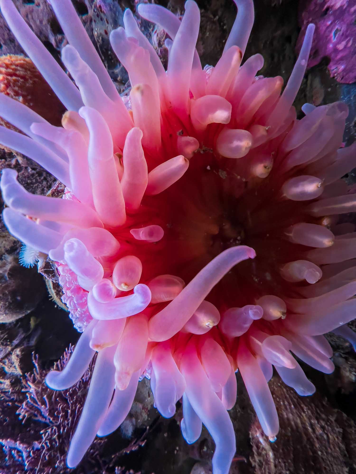
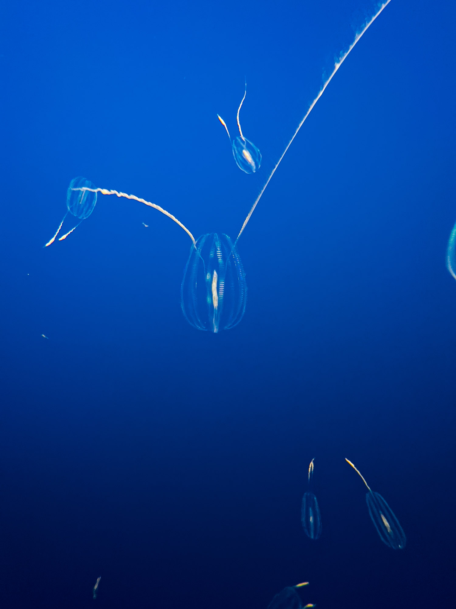
The amazing Monterey Bay Aquarium | iPhone 13 Pro
With our aquarium experience complete, we continued our walking tour of Monterey heading east/southeast past the last shops on Cannery Row and continuing onto a coastal walking and biking trail past the Coast Guard Pier to Old Fisherman’s Wharf. Here, we stopped in more shops and walked past restaurants just seeing where the wind would take us. After a stop for gelato we felt we had a full experience and headed back toward our parking spot near Cannery Row. And with this, our trip up the California Coast was complete.
Of course, there was still a lot of California to explore to the north, but with plans to drive inland and explore Yosemite this was all we had time for. In these three short days we’d gone from no firsthand experience on the California coast to feeling a bit of familiarity with the places we’d explored, the sort of familiarity that makes further exploration of these areas more approachable. The entire experience had been a series of pleasant free-roams in beautiful areas, just the sort of experience that I’d hoped for before setting out. And happy with this experience, it was onto the next one: A winter’s day in Yosemite.
Our last views of Monterey before heading inland to Yosemite | iPhone 13 Pro